Askern Spa with Snaith & Thorne Gyme's
Askern Spa owes its existence to an outcrop of upper Magnesian Limestone, capped by a layer of Upper Permian Marl, which dips near the A19 under a Bunter Sandstone. This sandstone in turn is covered by silts and clay, and in the region of Askern lake by a layer of peat. These silts and clays together with a small deposit of sand & gravel on top of the limestone outcrop are of glacial origin. The mix of rocks in this small area are what gave the local water its spa quality. A mine was sunk through the outcrop to reach coal at some depth under the limestone in 1911. This caused the spa wells to run dry.
The district known as Balne in the low lands east of Askern takes it name from the ancient spa at Askern. Latin 'balneum' meaning bath. The place name 'Thorpe-in-Balne' is in the same format as 'Sherburn-in-Elmet'. Elmet is known to be a Celtic kingdom. Could Balne be of Romano-British origin?
At the end of the last ice age 13,000 years ago, Askern Hill overlooked the large inland sea called Lake Humber which covered the land as far east at the River Trent. In 1775 a wind mill stood on Askern Hill but by 1881 this had been replaced by a later mill off Moss Road, close to where the Grange is now. This was owned by James Priestley, a farmer and miller.
Askern Lake is shown on a map dated 1720 as The Mear, its natural drainage is north into the river Went, but there had been drainage problems recorded as far back as 1371, and by 1775 a cut had been made to the river Don near Bramwith.
Until the Doncaster & Selby Turnpike Trust opened their new road though the village c1820, the journey north from Owston had been via Sutton, Campsall, and Norton Priory to Womersley. There is the site of an old ford on the River Went north of Norton Priory. Sutton Road, and in the north Campsall Road led to Askern, and Moss Road led out to Sykehouse.
The opening of the Lancashire & Yorkshire Railway in the late 1840's increased Askern's links with the outside world and added to the popularity of the Spa. A substantial hotel called Hill House was built on the side of Askern hill over looking the lake, this had landscaped gardens leading down to the turnpike road. There were two spa wells on High Street, South Parade Baths, and the Subscription Baths. A Bath House near the railway Station was owned by a Richard Greaves from Barnsley, and Manor Baths stood just east of the lake.
By 1881 the Crown Inn had opened on High Street, next to it on TheTerrace was the large house of Fredric Hindle. Also on the Terrace wasAskern College for boys and young men, run by Samuel B. Plevitt of Halifax. Hill House had become a Seminary for young ladies owned byGeorge Elliot Kent of Nottingham. Next along High Street came the Manor House followed by White Hart Hotel, and the Swan Hotel.
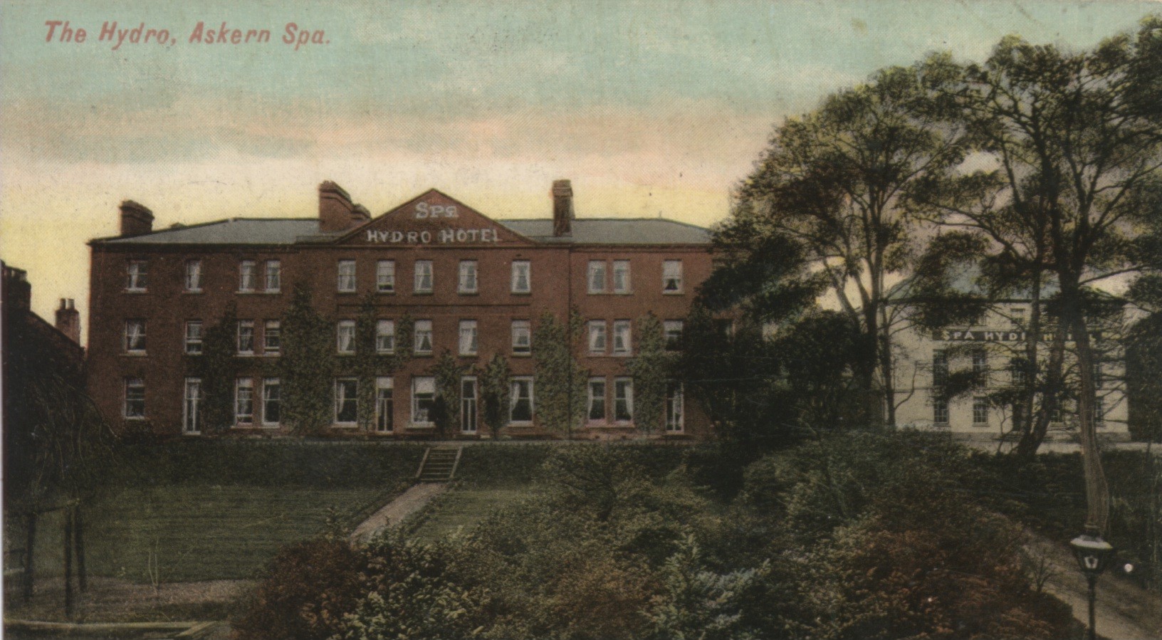
The final hotel to be built on
Askern Hill was the Spa Hydro. A photo taken about 1910 shows that this
hotel occupied all the Terrace, Hill House became an annex to the new
hotel. The Terrace is now derelict land to the north of the Roman
Catholic Church.

There are three places marked on the 1850s. Ordnance Survey 6" maps near the river Don called Gyme, each one is marked as a large pond. The name could mean a fresh water pond in an area, which was otherwise very marshy. There was fresh water spring of this kind near an old chapel at Lindholme on Hatfield Moor. Local roads lead to them indicating that they were of some importance. Ricard Gyme is named on documents dating from the 15th. cent. The name Lady Gyme could be much older. These Gymes are a similar geological feature to Askern Spa, this time the underlying rock is Bunter Sandstone.
Hansons Gyme (SE 682135), at Thorne is just east of Hansons Garth road, which is now a footpath. Stonilands Lane now White Lane, Hansons, Gyme Road now Lock lane, Hansons Garth road, Pinfold Lane, and Queen Street all meet at this point, Thorne Old Hall stood on Queen Street across the road from Hansons Gyme.
Another Gyme at Thorne (SE 678140) stood at the corner of Selby Road and Bloomhill Road. The site is still called Gyme on the 2000 1/25,000 Ordnance Survey map. Both Gyme's in Thorne have now been used as sites for new buildings, but are still recognizable a shallow depressions in the land.
At Gyme Corner East Cowick (SE 671216) there is a pond marked on the 1/50,000 Ordnance Survey map, to the east of the junction of the roads from Thorne, East Cowick, and Rawcliffe. This is now a large deep dry depression in the land which has been partly filled in. It is about 100 feet across and 30 feet deep. On the 1850s Ordnance Survey. 6" map this is called Ricards Gyme, the name is dated as Middle English in A. J. Smiths Place Names of the West Ridding 1958.
At Carlton Marsh just north of Snaith, a short stretch of the river Aire is called Lady Gime Reach. Lady is often a Christian updating of the Celtic water and wells Goddess name Ellen. To the north of the river Aire and west of the old bridge on the road to Carlton there is a large depression and pond which could be the site of Lady Gyme. The site has been partly filled in and is marked on the 1840 1" Ordnance Survey Map as a Dump. (SE 645229).All four sites are marked on the 1840 1" Ordnance Survey Map by a dark rectangle.
Lady Gyme