As new information becomes available this booklet is revised. The current revision date is 2022. Booklet ISBN 0950524301. Checked by McAfee for virus. Copyright M. R. Watson.
Brererley A history of Brierley
M. R. Watson
M. Harrison
1975/1976
revised 2003.
PREFACE
These notes on the history of the area have been collected over a period of about fifteen years. It was not, however, until reading R. B.Smith's book, in November, 1973, that I realised the important role that the Manor of Brierley, or Brereley as it was more usually spelt, had played in the history of South Yorkshire. To me, history has always been more interesting when related to how its effects can be seen in present-day landscapes and I hope that these notes will help others to see how time has shaped the village.
MICHAEL RICHARD WATSON
26th September, 1974
The village of Brierley was my home for the first twenty-three years of my life and still holds a very special place in my thoughts .However, I too only realised the past importance of my home village very recently, when this research was completed. I am very proud to have belonged to this village and my warm feelings for it have made my part in the writing of its history a great pleasure, rather than an arduous task. MARY HARRISON ( Draper)
23rd August, 1975
Contents
Early Landmarks of Brierley Manor
The Industrial Revolution in Brierley
Brierley Manor Court Roll for 1655.
Since completing the research for this booklet over twenty years ago I now have a clearer picture of the period preceding my starting date of 1086. Rather than rewrite page one I have decided to write this introduction to this floppy disk edition.
The ridge of high land on which Brierley stands separates the valleys of the river Aire to the north, and the river Don to the south. This is the meaning of the place name Brierley Gap. The rivers Aire and Don together with the marsh land of Thorne Moor in the east and the Pennine hills to the west, mark out an area that formed the southern section of the Celtic kingdom of Elmet (please see links page), which extended northwards to the river Wharfe.
Elmet was a small Celtic/British kingdom formed at the
fall of the Roman Empire it was bounded by the river Trent to the east
and south the Derbyshire river Derwent to the west the Pennine watershed
and the river Wharfe to the north. The kingdom survived until the battle
of Winwaed in AD. 654/5. This was the last in a series of battles which
saw Elmet become part of the expanding Kingdom of Northumbria. The site
of the battle is lost, but it may have been at Whinmoor near Leeds.
Whinmoor is on the Yorkshire section of Ryknild Street. Modern DNA
results show that the Celtic population of Elmet lived on in the area to
the present day.
Crossing places on the Yorkshire rivers have dictated where the early roads could develop. In the south, on the river Don, fords were developed at Rotherham and Mexborough. Roads from these two fords ran north to meet near Burntwood Hall. The road joint road ran through Brierley Gap to Nostell then split again, one line going to the ford across the river Aire at Castleford, and the other to Woodlesford near Leeds. These roads have been in continuous use from prehistory to the present day.
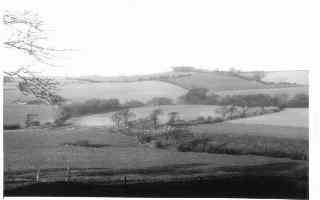
The Iron Age fort at Brierley Gap has been shown by aerial photograph to have been the centre of a Celtic farming community which had many small fields connected by farm lanes to the north of Brierley Gap. East of the A628 at National Grid reference 415116 there is a small mound called Askern Hill, that could be a tumulus.
M. R. Watson 2003
Brierley ! A field of briars! This is a possible definition of the name 'Brierley.’ but a precise definition is very difficult to achieve due to the many variations in the spelling of this name, which have occurred over the years. In the Domesday Book. our village is referred to as .Brerelia'. The Domesday Book spelling is Breselai or Breselie. Later, this name became Brereley, then Brearley from which we get one of our modern pronunciations. It was first spelt as Brierley. in some documents relating to the leasing of Brierley Manor by descendants of the Harryngton family, from Queen Elizabeth I in 1572. This spelling of the name was not commonly used until it appeared in a Manor Court Roll for 1665.The history of our village begins long before this ,of course. The ending .ley. is a Saxon ending and indeed Brierley was an early Saxon settlement. The Saxons came to Britain in the sixth century and there was an Anglo-Saxon battle near Fitzwilliam in A.D. 654.The fort at Brierley Gap, mistakenly called Saxon, is from a much earlier period - probably the Iron Age. This is the most northerly of a group of earth-works around the Sheffield area, best known of which are at Winkobank Hill and Carl Wark. The stones alluded to in the name Ringstone Hill. may belong to a group of stone circles from the same area and period as at Froggatt Edge and Arbor Low.The village grew first around the hill top on the Barnsley to Pontefract road where a small hollow and the sites of several wells provided a good building area. The well in the garden of Red House Farm may have stood on the edge of the square~shaped village green which stretched south~east from where Red House Farm now stands to where the Post Office is now situated. The first fields around this old Brerelia would be reached by way of Frickley Bridge Lane, Paty Croft, Cliff Lane and Ket Hill Lane. On the latter coal seams come to the surface and form part of the soil so coal must have been known to these early farmers. Sandstone and coal in alternate layers are the underlying rocks of the area. The village then grew in the direction of what is now Church Street. This street has many sharp bends which mark the corners of important fields. These developed over a large area with the extra access lanes of Wager Lane and Mackay Lane. The north east side of what is now Church Street Brierley has all the signs of a planned road with about eight small crofts each of them close to three quarters of an acre in size. The names of two of the early fields in Brierley have survived to the present day. Sow or South Croft Field to the south of Church Street and Cliff Field to the southwest of Church Street. These were sub~divided. The names of some of the divisions being Car Jug Close, Gill Croft, Le Long Roods,Stainforth Field and Rowall Flatts. Housing developed away from the green along Church Street, and the village gradually took the form it now has. The early field boundaries can be recognised on the Ordnance Survey Map by the irregular way in which they ring the village and by the winding outline of their hedges due to the ploughing methods of the time.
Early building would be of the Toft and Croft plan with the fields lying behind the crofts. The croft was the plot of land on which the toft or house stood. The early roads, crofts and fields have retained their original plan due to the village remaining largely agricultural. The buildings, of course, will have changed many times but will have remained on the original sites.
Brierley is sometimes referred to as "the village on the hill" and at the foot of the hill is Grimethorpe which has always been closely connected with Brierley. In fact, the name Grimethorpe could be the name of a Norse farm built close to Brierley village. On a well hidden site between Brierley and Grimethorpe stood the fortified Manor of Hall Steads (the name means .hall site'). which belonged to the early Brereley estate. One of the best places from which to view this site is from Brierley Lodge Farm. From there, about three hundred yards to the north, can be seen the mound on which the hall stood, and the almost circular moat which is marked by a line of trees. There are today remains of the stone dams which held this moat which was obviously formed by the modifying of a nearby stream and was stepped up the hillside. The deepest part of the moat is full of willows and now bears the name of Willow Garth. Under a nearby stile is a large, well-finished, limestone block which could be from the old building.
Site of Hall Steads
When the field within the moat is ploughed the shape of the building can still be seen on the high, centre section. The building appears to have been L-shaped with a large hall occupying the northern wall, the other part of the L being a south-east wing. Buildings of this kind often had a large hall used as a general living area with a chapel occupying the wing. Hall Steads was surrounded first by a high, stone wall, and then by the moat. The site covered an area of about five acres. The building was mainly of local sandstone and many of the stones can still be seen in the soil. Fragments of 14th and 15th century pottery have been found amongst these stones. In a field, four. hundred yards to the west of Hall Steads, there are the remains of several wooden buildings which could be the remains of the early Brelelia, but seem more closely related to modern Grimethorpe as they are different from the remains found at Hall Steads.
A track leaves the site and c1imbs the hillside towards Brierley.
At the time when Hall Steads was in use, this would have been an important road. It seems to have been used quite early in the history of Brierley and Grimethorpe and was the road from Hall Steads to Brereley. It ran from Brereley along the Flatts, down Tom Bank, forded the stream and climbed through the woodland, then down to the moated side. The deep, worn cuttings on this track mark its age.. When the manor moved to its present hilltop site, the road used became what is now Called Common Road. This road avoided the steep climbs and stream of the Tom Bank route.
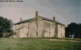
Brierley
Manor House
Following the Norman Conquest the Brierley Grimethorpe area came under the rule of the De Lacey’s of Pontefract. At the time of King Edward the local owner had been an anglo Saxon called Earnwine. Who was said to have six carucates of land at Brerelia and Hiendlia, valued at forty shillings. (A carucate was as much land as could be ploughed in one year by one plough and eight oxen. An acre was as much land as could be ploughed in one day by one plough and a pair of oxen ) There is a possibility that Hall Steads was occupied by Earnwine , although it is not mentioned until 1284 in connection with a later Lord of Brierley Manor. It is also possible that nearby Burnt Hill and Burntwood were so named due to the destruction of Brierley by William .the Conqueror. However, until this idea is proved or disproved by archaeologica1 evidence, it will remain in the realms of legend.
This land was given after the Norman Conquest to Alric who
was given the whole of Staincross wapentake by Ilbert de Lacey, the
Norman of Pontefract, (A wapentake is a division of land in the north of
England, corresponding to a Hundred in the South.) All of Yorkshire was
divided into wapentakes, Staincross being the one for Barnsley area. It
was about ten miles from north to south and about twenty miles from east
to west, its boundaries being in the north-east the high ridge on which
Brierley stands and in the south west the water shed of the Pennines.
For A!ric, it would have been a case of being monarch of all he
surveyed, for from his lands in Brierley he could look out to the south
west; and see all of Staincross wapentake spread out before him, right
out to the stone cross of Lady Cross on the bleak , Langsett Moors.
Another cross, also called Lady Cross, was erected near Grimethorpe,
probably by the monks of Monk Bretton Priory, as a place of sanctuary,
there being an old law protecting people on church lands. The Lady
referred to in place names of Ladycross, Ladywell and Ladywood is
probably Mary Magdalene to whom Monk Bretton Priory was dedicated. Monk
Bretton Priory, is more properly called The Priory of Lund. It stood on
the edge of Lund Forest, from which the village of Lundwood takes its
name. The base of this Lady Cross is now in St. Luke's
church Grimethorpe.
The point where the wapentakes of Staincross, Osgoldcross , and Strasforth meet is marked by two disused gate posts three hundred yards north east of the road at Burntwood..Thus, Alric ruled the wapentake of Staincross, though still subject to his over lords, the De Laceys of Pontefract. It is not known where Alric or his immediate successors lived but Hall Steads is a site of sufficient age and importance to have been his place of residence. Alric’s son Swein, became ruler in his turn and his name is perpetuated in the local village name of Hoyland Swain. He founded the present Felkirk Church and donated it to Nostell Priory. With the coming of Christianity, Felkirk had been chosen as the site of the church to serve the north east of Staincross. Its parish had a boundary of about eighteen miles and on the nearest possible day to Ascension Day each year, the priest and older men of the parish would take boys of the parish round these boundaries.
Sticks were carried. either to beat the boundaries or to beat the boys to make them remember where boundaries were. The tradition came to be called the beating of the bounds. On the journey round the parish. the party would stop to read the gospel for Ascension Day. ( St. Mark. chapter sixteen. verses fourteen to twenty.) The place chosen for this in the Felkirk parish was a thorn tree in Brierley. At Ascensiontide thorn bushes are usually the only bushes in flower and are covered with white blossom. This thorn bush in Brierley came to be called the Gospel Thorn. and must have stood somewhere in the two fields west of the manor house, as this area is referred to in later documents as Gospel Thorn. The De Laceys of Pontefract established two monasteries in the area: one at Nostell, dedicated to St. Oswald from whom Oswaldcross took its name and one at Pontefract, dedicated to St. John of the Cluniac Order. Alric's grandson, Adam Fitz Swein, founded the Cluniac Priory at Monk Bretton (St. Mary Magdelene of Lund) and met with the objection that two Cluniac houses should not be so close togethe,. an argument which went on for more than a hundred years. until the Monk Bretton order was changed to Benedictine. It was possible that the true discontent was due to the fact that a Saxon had grown powerful enough to found a monastery at all. The village of Brierley was very closely involved in this argument as, when Swein had founded the church at Felkirk, he had donated it and its parish. which included Brierley, to the priory at Nostell. He had also founded the church at Silkstone and, it seems, had also included Brierley in the parish of Silkstone, this parish coming under the joint jurisdiction of the Cluniac priories of Monk Bretton and Pontefract. The dispute was a very real one in economic terms, for it concerned the tithes payable to the church by the various villages. At this time two parts of the tithe of corn from Brierley was payable to Monk Bretton Priory and to St. Oswald Priory at Nostell, the tithes being payable at Whitsun and Martinmas. During the period of these arguments, Hall Steads had come into use, probably first as a residence for Adam Fitz Swein's daughter, Matilda, and certainly by 1284 as a home of Geoffrey Nevile of Brierley. The dispute was finally settled on the 2nd February. 1317, when it was decided once and for all that Brierley should form part of the parish of Felkirk.
An old road from Monk Bretton Priory to Hall Steads still
exists and crosses the hall enclosure on an earth bank over the moat. This
road
passed
by Ferry Moor which was a grange or outlying farm belonging to Monk
Bretton Priory. In Grant of lands to Monk Bretton priory
(St. Mary Magdelene of Lund) by Roger de Montbegon grandson of
Adam Fitz Swain c1220 the area is called Fasham. Later in 1778
Earl Mexborough of Methley Hall had a
map drawn of his 115 acre estate on higher land at Ferry Moor. The
low lying land was permanently under flood. making it valuable for
fish and rushes. Ferrymoor Grange was one of two in the area, the
other was the Howell Grange near Clayton this was a farm of over 100
acres with woodland of 160 acres. This
belonging to the priory of Nostell.
Adam Fitz Swein had two daughters named Amabel and Matilda .The latter married John Malherb, and the couple were given brierley as their home. On the death of Adam, the estate was shared by the two daughters. Amabel receiving Cawthorne and Matilda, Brierley. From then on, Brierley passed to the Longviliers and then the Neviles. When Sir Geoffrey Nevile died at Brierley in 1284, the village was described as having one hundred acres in demesne, thirteen acres of meadow with manor, garden and fishsponds. This is the first mention of the manor as a building. At this time it was probably a kind of summerhouse on its hilltop position, overlooking the moated hall The manor house later became the centre of administration for the area. Now, having been repaired several times, it still dominates the landscape around Brierley. In 1288, a grant of land by Margaret Nevile of Brierley gives an interesting description of the village: Margaret, the widow of Geoffrey Nevile, gave to Bernard de Brearley, who was a clerk, a carucate of land and twenty acres of meadow in Brierley and Grimethorpe. The grant reads as follows: "Bernard and his heirs to hold of the chief Lord. Margaret for herself and her heirs has further granted that Bernard and his heirs may have reasonable estovers to burn, build and enclose in all woods of Margaret and her heirs in the said towns, without a view and livery of the foresters; also that they may grind all kinds of grain coming from the said tenements at the mill of Margaret and her heirs of Brierley". ( Estovers were the rights to cut and collect wood.)
This manor of Brierley was held in 1347 by Sir Robert Nevile who also held the manor of Hornby, which is in Lancashire, and from these controlled many Yorkshire and Lancashire villages. Hornby is a small village, eight miles northeast of Lancaster and is linked with Brierley history from 1335 to1583. Some time between the seventh and ninth century, local people, having been converted to Christianity, had erected a stone preaching-cross in the village of Hornby.
Lords of Brierley Manor.
I086 Alric, with all of Staincross Wapentake
Swein all of Staincross Wapentake
1158 Adam Fitz Swein all of Staincross Wapentake
John Malherb Brierley village
1232 Hugo Longvillers Brierley village
1254 –1279 John Longvillers Brierley village
1279- 1284 Geofrey Nevile Brierley village
1284- 1289 Margaret Nevile Brierley village
1289- 1335 John Nevile Brierley village
In the period of monastic building, a small priory had also been erected by the pre-monstratensians, to the west of Hornby, and this spot is now marked by Priory Farm. In the thirteenth century the village had made history when Roger de Montbegon of Hornby had helped other barons to force King John to sign the Magna Carta. Roger died in Hornby in 1228. By 1335, Robert Nevile had become the first lord of the combined manors of Brierley and Hornbv and ruled them from Brierley until 1347. From then on, the manors stayed together under the Neviles and later the Harryngtons. By 1424, Sir William Harryngton held twenty-one Staincross villages from his manor at Brierley, together with his lands at Hornby. This is when Hall Steads really came to its height. It was the ha11 of the Brereley Park of the Harryngtons. The park contained Hall Steads, the manor house, and Lodge Farm. It covered about four hundred and twenty-five acres and was bounded by, but did not include, Spa Well, Tricket Head, Brierley Common, Grimethorpe village, Tom Bank and West Haigh Wood. The boundary can still be seen as a wall along the side of the Common and as a grass mound along the side of West Haigh Wood, Tom Bank Wood, Spa Well Plantation, Car Plantation and Ladywood are plantations within the Park whilst Howell wood, Burntwood and West Haigh wood are the remains of a forest which stood between Brierley, Kirkby and Great Houghton. In West Haigh Wood (at grid reference 426088)there is another mediaeval enclosure similar to that at Hall Steads. It lies only half a mile from Hall Steads but stands outside the land known to be owned by the Harryngtons and no documentary evidence has been found to explain its presence. It covers about one acre and is enclosed by trenches or ditches which are about three feet deep and six feet across. Its general shape is one large rectangle, one hundred yards by one hundred and twenty yards with a smaller rectangle on the south east side. Thus from the midst of this Brereley Park Sir William Harryngton ruled his villages. In 1447, his son, Sir Thomas Harryngton, was Sheriff of Yorkshire and in 1458 joined the Duke of York for the ensuing Wars of the Roses. John Harryngton, Thomas's son, had married Maud Clifford, sister of Lord Clifford of the House of Lancaster and so it seems that the troubles of the times split the family. Another son of Sir William Harryngton is thought to have left Brierley and settled at Kelstone near Bath. Sir Thomas and Sir John Harryngton died at the Battle of Wakefield which took place near Sandal Castle on December 29th, 1460. Sir Thomas's will asked that he be buried at the priory at Monk Bretton.
John Harryngton left two daughters: Ann, aged five and Elizabeth aged four. Their uncle, Sir James Harryngton, took care of them and presumably took over at Hall Steads. His custody of the girls, who were heirs to the estates of Brierley and Hornby, was challenged. A letter was.’ found', saying that their uncle was keeping them prisoner and they were therefore put under the guardianship of Thomas Stanley of Lancashire.
In 1485 Sir James Harryngton, the uncle who had been on the side of Richard lll at the Battle of Bosworth, was dispossessed of his lands and left the country.
It is possible that this is the time when Hall Steads was abandoned, as the estates of Brierley then went to the Stanleys of Hornby. The Stanleys had started as the chief foresters of Wirrall and became a leading Lancashire family. Edward Stanley married Ann Harryngton and this gave the Stanleys control of the Harryngton estates at Brierley and at Hornby. Edward was later given the title of Lord Mounteagle for his decisive leadership of the English archers at the Battle of Flodden. He was also an accomplished musician and played at the court of Henry V11 at the King's request. Edward's father,Thomas Stanley, was given the title of Earl of Derby for his support of Henry Tudor at Bosworth.
The Harryngton family never gave up their claim to Brierley. In 1503, a James Hairryngton had the dispossession of his grandfather reversed in order that he might inherit his mother's lands. It is not clear as to whether this included Brierley Manor. He was Rector of Badsworth church with which the Harryngtons had connections. Ann Harryngton, who had married Sir Edward Stanley, died and as she had no children, her sister, Elizabeth Harryngton, who had married Richard Beaumont, considered herself to be sole heiress to Brierley Manor. On failing in her claim. she gave her support to her cousin, John Harryngton of Slaidburn, who was later found to have been poisoned. The old castle in which Roger de Montbegon lived is now a moated site to the north of Hornby and it is interesting to note that it is called Castle Stede, whilst the old hall at Brierley was called Hall Steads. (Stead is the old English word for site.) The old castle was replaced by one built by Edward Stanley in 1513 on the banks of the River Wenning. To the east of this are the woods that are the remains of Hornby Park. The Mounteagle coat of arms can be seen on the church tower at Hornby.
At this time. the materials used for building were changing. The dissolution of the monasteries in 1539, as at Monk Bretton, led to vast changes in the economic structure of the country and one of the results of the changes was the increased use of stone for domestic building. Many of the stone barns now seen date from this period. Another change which came about with the dissolution of the monasteries was that for the first time many people were able to become farm owners, though still paying to the manor in the form of leases or free rents. After a few prosperous generations, these farmers were able to re-build their farms in stone.
Towards the end of this century, in 1580, on the death of the third Mounteagle, the Brierley Hornby estate was sold up. Only the castle and Hornby remained with the Mounteagles, whilst Brierley was sold to the Earl of Shrewsbury who bought it for his son, Edward Talbot. Thus the link between the history of Brierley and Hornby was severed.
The title of Lord Mounteagle passed from the Stanley's to the Parker family.
Guy Fawkes of Gunpowder Plot fame, joined the regiment of a later Sir William Stanley and learned the art of using gunpowder to blow up military defenses. His skills earned him the rank of Captain. The story of the Gunpowder Plot is well known. On the 26th. October 1604 a letter was sent to Lord Mounteagle-Parker advising him not to attend the House of Lords. This led to the discovery of the plot and the arrest of Fawkes
In June 1643 Parliamentary forces captured Hornby Castle and the Mounteagle reign came to an end.
Edward Talbot had New Hall,.Pontefract, built as his home
from the stones of St. John's Priory, having paid two hundred pounds for
the carting of them. Lord Talbot, though choosing to live at Pontefract,
used Brereley as the head of the estate, and so the Court Rolls of this
period are headed. Brereley Manor.
At the time of King
Edward the Confessor Cudworth was in the estate of Stapleton
near
Darrington. Anglo Saxons Barthr and Ulfetill held the land. They were
replaced after 1066 by a
At the Manor House, Manor Courts were held in October of
each year. The actions of the Court were recorded on what are known as
Court Rolls. The Court Rolls for Brierley Manor show that though the
Lord of Brierley Manor held lands in many of the villages of the south
part of the West Riding, the core of the Manor was Brierley, with
Grimethorpe,South Hiendley and Shafton. At the time of King
Edward Shafton was a separate Manor held by Alsige who had 18
Carucates of land there and in Carlton.
Brierley Manor Court dealt with the administration of the area on behalf of the Lord of the Manor. The Court rolls relate to the business of the various courts of the Manor,. Baron, Leet and Frankpledge. Of these, the Frankpledge is the most interesting as it deals with the population of the area. Its chief purpose was to determine to which village a man belonged. The court seems to have been held once a year, surprisingly enough, even during the Commonwealth of Oliver Cromwell and his son Richard.
The Yorkshire Fines, dating from the period when Lord Edward Talbot was establishing himself in the manor at Brierley, give an insight into land-ownership and transfer at this time. A fine in this context was a fictitious suit at law which played the part of a conveyance. It could be a payment to the Lord of the Manor on the renewal of a lease, or a form of land transfer. The landowner became the plaintiff and the tenant, or leasee, the deforciant (defendant). The term messuage used in these documents meant a dwelling, including outbuildings , orchard, courtyard and gardens.
Lords of Brierley Manor.
1335-1347 Robert Nevile. Brierley and Hornby
1347-1403 Sir Robert Nevile. Brierley and Hornby
1403-1438 Sir William Harryngton {In 1424 he held the manors of Brierley and Hornby and held lands in 23 Yorkshire villages)
1438-1460 Sir Thomas Harryngton
1460-1485 Sir James Harryngton
1485-1489 Thomas Stanley
1489-1523 Sir Edward Stanley {Created Lord Mounteagle in 1514. He too. held the Manors of Hornby and Brierley and held lands in 21 Yorkshire villages)
1523-1560 Sir Thomas Stanley~Lord Mounteagle
1560-1580 Sir William Stanley~Lord Mounteagle.
The first fine of interest is dated 1572 Trinity Term. The Queen is the plaintiff and the deforciants, Stephen and Richard Harryngton. The land in question is the manor of Sedbergh, Langor-in Dent and Brierley (spelt .Brierley!). This is the first record of this present spelling of Brierley, earlier spellings being .Brerelia', .Brereley', and .Brearley'. This modern spelling of.Brierley was not found in common use until a century later. The fact that Harryngtons are mentioned at Brierley Manor at this time is surprising, as almost one hundred years had passed since the Manor of Brierley was given to the Stanley family. It was well known that the Harryngtons had contested the Stanleys rights to Brierley Manor and it could well be that this fine, issued by the Queen, was intended to establish who had the rights to the manor.
In Michaelmas term of 1574 we find another fine issued. This time, the plaintiffs are John Whittakers and Thomas Mart, gentlemen,the deforciant being William Stanley Knight, Lord Mounteagle, and land in question is the Manor of Brearley, Shafton, Sedbergh, and Langor~in~Dent, almost the same properties which had been contested two years earlier by the Harryngtons. This again. probably comes in the context of a fine issued to establish the rightful ownership of these manors.
By Easter Term, 1579, another fine had appeared. This
time, the p!aintiff is George, Earl of Shrewsbury, the deforciant,
William Stanley, Knight, Lord Mounteagle, and the land in question the
Manor of Brearley with two hundred messuages and a windmill. With lands
in Brearley, Shafton. etc. This is the fine which cleared the way for
the Earl of Shrewsbury to acquire the Manor of Brierley for his son,
Edward Talbot, in 1580, and it is interesting to note this early mention
of the windmill in Brierley. This wind mill is clearly
marked on Thomas Jeffrey's 1771 map of Brierley,
but it had been taken down by 1854 when
the first 6" Ordnance Survey map was published.
Shafton receives a special mention in these fines as Thomas Harryngton had given to his son, John Harryngton, the Manor of Shafton as a special gift, thereby taking Shafton out of the direct rule of Brierley Manor. Following the death of John Harryngton, his widow, Maud, married Edmund Dudley and for a time their names appear in connection with this manor at Shafton. (Cultivation appears to have been carried out to a great extent here, as there were eighteen carucates of land under the plough in the eleventh century.) The final fine in this sequence is dated 1586 Trinity Term. Here, the plaintiffs, George, Earl of Shrewsbury, and Edward Talbot, are establishing Henry Compton, knight, and Lord Compton as stewards at Brierley Manor. The land again is described as 'The Manor of Brearley with two hundred messuages and windmill with land in Brearley, Shafton, etc’.
These fines also show that there was another, lesser-known manor in Brierley, the manor of Folly Hall. In a fine dated 1584 Trinity Term, we find Robert Swift as plaintiff and Robert Lee, esquire, as deforciant, the lands in question being this time, the Manor of Follyatt Halle ( Foliot) and six messuages and three cottages with lands in Balne, Pollington, Campsall, Snaith, Norton, Kirk-Sandal and Strisethorpe. In Balne there is a piece of woodland called Folly Hall Wood. As the lands mentioned above are all close to Balne and not Brierley it is possible that they belonged to Folly Hall Balne.
The 'Foliot' family were given land in Fenwick, a hamlet
in the Balne area by the de Lacy's of Pontefract. The area of Balne in
the lowlands east of the A19 between the rivers Air and Don, marked in
the north by the hamlet of Balne and in the south by Thorpe in Balne,
could take its name from the ancient spa at Askern which was known to
the Romans. The name comes from the Latin 'balneum' meaning bath.
Folly Hall Brierley stands a quarter of a mile to the
northwest of the road to Hemsworth. As with all farms in the area,
re-building has been carried out throughout the centuries resulting in a
mixture of building styles. In 1840 it was owned by a
widow called Ann Smith. It was occupied in
the period 1851 to 1891 by the Cooper and Wilson
families related to George Wilson the Saddler
and Post Master at Brierley.
Folly Hall
In 1597 Lord Talbot commissioned the map maker Christopher Saxton to produce a plan of the village of Shafton. This plan shows the village in great detail. There were then five town fields, these being Lydgate Field to the north-west of the village, Eshbarrowe Field to the north, and Townend Field to the north-east of the village. The two other fields were on each side of the road to Ferry Moor which was then Shafton Common. These were Nether Field to the west of the road and Heade Field to the east. The fields were mainly open plan but there were some freehold enclosures belonging mostly to a Mr Edward Jenkinson. The village had two gates called Lydgates, one at the start of Lydgate Lane and the other on the lower west corner of Shafton Green. Near to this was a small bridge over a stream called Sandal Bridge being on the road to Sandal Castle. This is now corrupted to Sandy Bridge. Shafton Manor House or Hall stood on its present site close to four cottages. There were nine more cottages on what is now Chapel Street and ten more on Hawthorne Street.The pinfold stood at the south corner of the village green. where it remains today. Ferry Moor Farm is shown as the home of Ferius Rayne.The Rayne family had bought Ferry Moor Farm from John Byron in 1569 together with the farm at Tyers Hill Darfield. Ferry Moor Farm stands at the west of Ferry Moor Common between Shafton, Grimethorpe and Cudworth.
At the end of the sixteenth century we find the first mention of Ringstone Hill Farm, for in 1593. a Ralph Smith died there intestate. There is a record of this in the Doncaster Probate for that period. Standing between the common and Old Brereley Park. on the Rotherham to Wakefield Road., Ringstone Hill Farm became an inn.
This
Inn
at Ringstone Hill was on the busy road between Wakefield and
Rotherham, part of this road is now the B6273 between Nostell Priory
and Wombwell. Celia Fiennes in her
book ‘Through England on a Side Saddle’ writes of a tour of England in
May 1697. Traveling from Pontefract to Rotherham see page 81, two
miles past Hemsworth her small company could only find a small ale
house (Ringstone Hill Inn) with only pots of beer for them, a short
distance later at (Burntwood Nook) later to become Burntwood Hall a
clergyman Mr. Fferrer gave them hospitality and good beds.
In the seventeenth and eighteenth centuries this Inn served soldiers training on Ringstone Hill. On Brierley Common. to the north-east of the farm. is a rectangular enclosure of about nine acres. (Grid Reference 427103) This enclosure is detached from the other walls and hedges in the area and is surrounded by ditch and low bank. This field is known as Oak Royd and may well have been the site of the military camp, for it is one of the earliest enclosures in Brierley. Today it is the field in which the Good Friday Fair is held. We are able to date the period in which Ringstone Hill was used as a military camp, for in 1588. the men of Brierley were summoned to assemble at Woolley Edge to prepare for the coming Armada. and in 1855 the Army decided to discontinue use of Ringstone Hill as a military camp, on the grounds that it was too small for their purposes. There are several references to Ringstone Hill as a military camp between these dates. The first is a reference to Sir Godfrey Rhodes of Great Houghton Hall holding a military camp there in 1642. Then, in 1645, four pounds thirteen shillings and three pence was paid for a military guard at Ringstone Hill by the townspeople of Sheffield. Again, when the Dutch Invasion was expected in 1665, the men of Brierley were ordered to meet at Ringstone Hill to train with the regular soldiers. Four shillings and two pence was paid to soldiers training at Ringstone Hill that year.
Also on the Common, is the site of an old oak tree known as ‘Old Adam'. The tree stood where the tracks from the manor house and Ringstone Hill now meet the Rotherham road. It was described as having been twenty-seven feet round its trunk. It was hollow, and on the north side a large branch had been blown off by the wind whilst on the other side were vigorous 1imbs. The tree was the last of a small wood called the Well~Bred Oaks, which dwindled down to two trees called the Adam and Eve Oaks and then to just 'Old Adam.' The tree became a dead trunk in the twenties and had gone by 1930.
On the third of December, l666, John Holgate of Grimethorpe married Helen Seaton, thus introducing the Seaton family to the village. In January of 1669, Robert Seaton married Theodicia Adwick ofArksey and built Grimethorpe Hall as their home. Robert Seaton born 1638 became a Quaker he was the son of Gervas Seaton a Yeoman of Blyth Nottinhamshire. The hall is one of the earliest classical buildings in the area. The north wall is all stone and the doorway has a segmental head; the rest of the building being of combined brick and stone with tall pilasters framing the south door. The ceiling of the entrance hall is supported by three stout Doric columns.
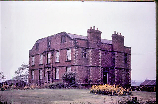
Grimethorpe Hall
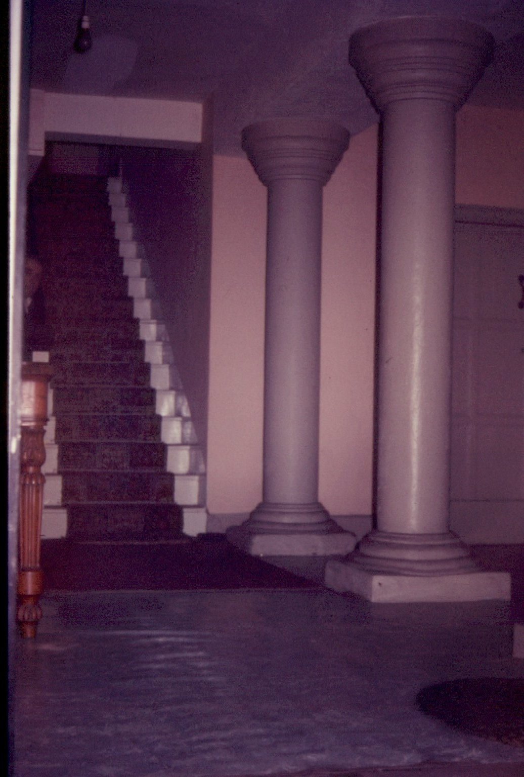
Hall Entrance
Another member of the Holgate family, George Holgate, seems to have had his name in the charts in quite a different way. In 1665, when freeholders of Brierley were summoned to assemble at Ringstone Hill with the militia, to prepare for the Dutch Invasion, Thomas Wood, Thomas Dymond and John Hellilay did as they were bid, but George Holgate refused. It is thought that he refused on religious grounds because he was a Puritan.
Meanwhile, at Grimethorpe, Robert Holgate was also in trouble, being unable to pay his debts. In a deed of conveyance, dated l685, for lands in Grimethorpe from John Hall of Hull and John Arthur of Doncaster, mention is made of an earlier dealing for the same land, on the 17th May, 1680, between William Spencer of Thurnscoe and Robert Holgate of Grimethorpe. The land in question was a farm at Grimethorpe with land at Tom Royd Ing, Moss Close, Dyott Roods, Judd Croft, Grey Croft, Nether Croft and several cottages. Robert failed to pay two hundred pounds for this land to Daniel and Thomas Hall. The land then passed to John Hall who sold it for nine hundred pounds.
In the mid seventeenth century Widow Speight of Grimethorpe held 116 acres of land in the hamlet and was tenant of the water mill, a horse driven mill, and the wind mill on the hill top between Grimethorpe and Brierley. Then in 1662 William Speight paid £7 rent to Brierley Manor for the mills.
The water mill stood at Grimethorpe Green and the complex system of water courses in Grimethorpe owes its origin to the problem of getting a good flow of water to the mill over relatively flat land, there being a difference of only forty feet or so between the level of the upper dam at Tom Bank and Ferry Moor into which the mill stream drains, a distance of one mile separating the two points. The remains of this upper mill dam can still be seen spanning the valley at the corner of Tom Bank Wood. Four hundred yards downstream are the remains of a second dam which held the lower mill pond.
Lord Talbot enlarged the park at Brierley by enclosing land to the south-east of the old park. This new park included most of the village of Grimethorpe and its common which caused the village to shrink almost out of existence. A similar thing had happened at nearby Kinsley where the mansion and park of the Burtons engulfed the village in the 15th century. The site of the Burtons hall is now marked by a moat close to the modern village of Kinsley. Nearby is Newstead Hall which replaced the old mansion in the late 17th century. By the time of the early Saviles New Park Brierley had become firmly established and its name appears on several Savile documents.
Soon after the turn of the century in 1617, Lord Talbot died, and as he had no heirs, the manor of Brierley passed to the Savile family. New Hall at Pontefract gradually became Old Hall and was pulled down earlier this century.
Jurors of Brierley Manor Court
In 1655. the jurors of the Court Baron were:
Francis West of Denby,
George Holgate of Brierley ,
John Micklethwaite of Ingbirchworth
Richard Gill of Hodroyd ,
William Cawthorne of Brierley,
Robert Blackeburne of Denby ,
Jonas Clarkson of Shafton,
John Hellilay of Brierley,
George Pitt of Shafton,
John Rishworth of Brierley ,
Richard Cusworth of Royston ,
Thomas Wildsmith of Birthwaite
Jude Clarkson of Brierley,
Daniel Ellis of Worsborough.
The Savile family came from Thornhill, Dewsbury. Sir George Savile, of Thornhill, died in 1622 and Lady Ann Savile became guardian of the Lord of the Manor, William Savile until he came of age. In a document, dated 2nd. October 1631, she is described as being .farmer to the King of the Manor of 'Brearley'. Sir William Savile died in 1645 supporting the royal cause in the civil war. He was the second lord of Brierley Manor to die conflict. His son Sir George Savile did much for the Manor of Brierley from the family estate at Rufford Abbey Nottinghamshire. The manor house was extensively repaired and the coal mine near Gill Croft was developed. He also re-established the rights of the Lord of Brierley Manor for lands. in outlying districts, which had been the property of the Harryngtons.
It is likely that the role of Brierley Manor had been growing less and less important since the Harryngtons had left the village. For the Stanleys. it had been the manor controlling their Yorkshire estates, under Lord Talbot it was the manor of just the local areas.
During the Savile period. in 1632. considerable suns of money were spent on the repair of Brierley Manor House; it is probable that the earliest surviving walls are from this period.
In the civil wars of the 1640's, the Dewsbury home of the Saviles, Thornhill Hall. was destroyed by the Roundheads. after being defended by Lady Ann Savile. The Savile name is to be seen on the Court Rolls for this period. The surviving Court Roll of the Mounteagle period is on a single sheet and unfortunately illegible, four Court Rolls from the Lord Talbot period have survived but only part of these can be made out; but the Court Rolls from the early Savile period are quite legible and very substantially written.
Here is a heading taken from one of these rolls:-"Brearley Manor. The great court baron Sir George Savile.baronet, lord of the said manor. holden at the Manor House Brearley on the sixteenth day of October, in the twelfth year in the reign of our sovereign Lord. Charles."
The Court Rolls dated 1640 to 1685 are headed 'For Sir George Savile' and are addressed .Brearley. or .Brerely. up to 1665 and 'Brierley' from then on.
These are set out with the names of the villages controlled by the manor and under the name of each village are the names of the head of each household. The villages named include Brierley, Shafton, Hiendley, Royston, Worsbrough, Ingbirchworth, Penistone and Skelmanthorpe. It shows that the holding of land by Brierley Manor had grown again so that it was equal to the amount held at the time of the Harryngtons. The table of villages held by the Manor reflects the growth under the Harryingtons and the Stanleys. Then, there is a shorter list of holdings by Lord Talbot, followed by the list showing re-growth of the Manor under the Saviles. Once again. these rolls have been used to answer certain questions: Exactly which towns or villages were held by Brierley Manor at this time? How does the list of jurors or members of the Court relate to the residents of Brierley?
A true picture of the population of the village is difficult to achieve, due to the fact that residents of the village and landowners of the village are indistinguishable on the Court Rolls. However, in 1662, there were sixty-five rented properties in Brierley with Grimethorpe, sixteen rented properties in Shafton and fourteen rented properties in South Hiendley.
For 1655, Henry Fidling was chosen constable of Brierley, John Wager and John Colly were chosen bylawmen and Attestators for Brierley; and Richard Mann was continued as pinder for Brierley (The names .Wager. and Fidling are still in use in Brierley. Wager is the name of a lane leaving Church Street on the north side between what is now Hall Farm and the Brierley Methodist Church. Fidling Farm is also on the north of Church Street, adjacent to the school). John Stoley was chosen constable for Shafton; Richard Marshall and John Swift were chosen bylawmen for Shafton; Richard Milner was chosen constable for South Hiendley, Thomas Huddlestone and Ralph Downs were chosen swornmen for South Hiendley, they were also bylawmen for South Hiendley.
Listed as freeholders in townships of the Manor for 1665 are Robert Hartcliffe of Cannon Hall.,Cawthorne. and William, Lord Viscount Wentworth of Barnsley.
For Denby, there is an entry saying that Richard Clayton is dead and that Thomas Moorhouse enjoyeth his lands in the right of his wife.
There is a similar entry for Royston saying that .George Wood is dead and that John Wood is his heir.
Also for Thurgoland. is an entry saying that .Anthony Moorwood is dead.
The list of jurors of the Court Baron shows that the residents of Brierley had a greater representation on this. and therefore, probably a greater say in the affairs of the court.
Also in the Court Rolls is the other business of the Court with entries such as 'We do present that the inhabitants of South Hiendley have not made sufficient horse way at Baynebridge Gate within the field leading towards Wakefield, according to a paine. formerly laid whereby they have forfeited 30 shillings'.
A full transcription of the Court Roll for 1655 appears at the back of this book.
Also, with the heading 'Paines Laid' are the instructions of the Court. Between 1614 and 1660. the following instructions were given to people at Brierley:
That John Marshall do not drive his goods through Henry Pitt's croft . That the inhabitants of Brierley having pits in Sow Croft do fill them up.That George Green do scour his ditch at the Flashes.
That William Berry do make his hedge at Sollil Mills.
That the inhabitants of Brereley do make their furrows scour before the 11 th November.
That the inhabitants of Brereley do scour the land near the highway on both sides.
That John Hoyland shall allow sufficient way for access as formerly accustomed.
That the township of Brereley do repair and fill up the quarry above the Common Pinfold.
That Francis Wildsmith do scour his ditch in Broad Lane.
The time usually allowed for these tasks was until the next Court meeting. The reference to pits in Sow Croft may be to South Croft where the Wesleyan Chapel was built. The entry that George Green do scour his ditch' appears more than once~he must have been one for not scouring his ditches! The word 'scour' as used in these instructions seems to mean generally clean up. The lines could be read as: That George Green do clean out his ditch in order that water would run freely and the ditch not silt up. The inhabitants of Brereley are told to make their furrows straight. In the open field system of the time, furrows that deviated too much would encroach on the next person's land which would lead to obvious problems. The existing pattern of curving field boundaries is due to recurring curves in the lines of furrows becoming accepted as the established boundary, the walls and hedges of the later enclosures being built on these displaced lines. The inhabitants of Brereley being told to clear the land near the highway could be related to the general problem of road maintenance of the seventeenth century. The instruction to leave sufficient way for access suggests that these people lived at the side of or had land adjoining the lanes leading to the fields and were obstructing these in some way. The Pinfold mentioned stood on Church Street opposite where the Church now is. These Rolls were written by John Stanhope who was steward of the manor during this period. Since for quite a time the Lords of Brierley had not lived Brierley, the Mounteagles choosing to live at Hornby, Lord Talbot at Pontefract and the Saviles at Rufford, several Brierley families were able to have homes of hall status in the village. The first of these was the manor house itself. In the mid-seventeenth century it was the home of John Stanhope, and by 1701 had become the home of John Cawthorne. The period 1665-1671 is covered by a Court Book, as opposed to the Rolls which are large sheets of paper. The 1672-1685 Court Rolls are very substantial but almost illegible. We can see from the several Court Rolls of Brierley Manor which have survived, covering the period 1538-1685, that Brierley was the leading manor for the Staincross area at this time.
On the north side of Common Road at the flashes (grid reference 419109.5) there are the remains of house and out building foundations, is this where George Green lived?
Lords of Brierley Manor from 1580
1580-1573 Earl of Shrewsbury
1573-1617 Lord Talbot of New Hall Pontefract
1617-1622 Sir George Savile of Thornhill Dewsbury &
Rufford Abbey
1622-1645 Sir William Savile died in the civil war
supporting the royal family.
1645-1784 A long line of Sir George Saviles living at Rufford Abbey
EARLY COAL MINES IN BRIERLEY
The unofficial coalpits in South Croft have already been mentioned. One of the reasons why the villagers were ordered to fill them up may have been that they were competing with Sir William Savile's coal mines in Brierley. These were in the area of Gill Croft and Pitt Croft. The nature of the documents dealing with these mines suggests that they were bell pits or shallow drift mines. A bell pit was sunk to a coal seam just a few feet from the surface. The coal was then dug out to form a bell-shaped chamber from which the mines get their name. No kind of propping was used, so that when the roof became unsafe the pit had to be abandoned. Another pit was then sunk close by to continue working the coal seam. Drift mines were usually sunk into the hillside to follow coal outcrops underground, these again were worked until they became unsafe. Timbering was used in these larger mines, and in 1638, one pound thirteen shillings was paid out for pit props in the mines of Brierley. In the same year, eighteen shillings and sixpence for the fixing of a water pump in a pit at Gill Croft, probably to divert water from a spring.
It is possible that the re-discovery of these chambers of these early coal mines has led to so many secret tunnel legends abounding in the area. The pits in Gill and Pitt Crofts were mainly mined by Robert Hemingway on behalf of Sir William Savile, and in 1638 the total amount paid out in these mines was fortyfive pounds seven shillings and elevenpence. This was broken down into accounts such as; Paid to Robert Hemingway for the drawings of one pit in the bottom of Gill Croft, eight shillings and sixpence, paid to John Law and others for two shillings. On the 26th October, 1641 these pits were leased to William Speight for a period of ten years, for thirty pounds per year. William Speight also leased a messuage with lands in the village for thirteen years at twenty-eight pounds per year.
One hundred yards to the south-east of Lindley House is a deep ravine at the head of which is a subsided mouth of a long-disused drift-mine; this could well be the mine from which Pitt Croft received its name. Nearby , in a field to the south of this, is the subsidence of another drift-mine and one bell pit. Further downstream. past the sewage works, are the remains of three small drift-mines. These are just above the water-line of the now dry upper milldam mentioned elsewhere. All five mines were dug in a north-westerly direction into the upper coal seam called Brierley Coal. This can be seen to outcrop near one of the old mines. The over-lying sandstone is known as Dalton or Brierley Rock. The land to the north of Ket Hill Lane is called Pitt Hill and may have been the site of yet another coal mine in Brierley, though there are no signs of workings.
Near to the manor itself stands Ringstone Hill. It is the highest point of the ridge on which Brierley stands. Most of the village is at three hundred feet above sea level. with the nearby valley of the river Dearne at one hundred and twenty feet, making Brierley's hill quite outstanding. The ridge stretches from Clayton in the east to Ryhill in the west. In some places it reaches three hundred and fifty feet and at Ringstone Hill it reaches four hundred. The whole area forms a natural barrier between Pontefract and Barnsley. The hill top of Ringstone is best seen early in the morning from Common Road Brierley, with the sun low in the sky. It is then easy to see why prehistoric man chose this site for religious uses. Nothing is left now of the stones from which the hill top gets its name, the hill being occupied by an undercover reservoir. (At Ripponden. near Halifax.there is a hill-top named Ringstone Edge: this hill gets its name from a circle of cairns.) Ringstone Hill farm. as already stated, was at this time an inn and the innkeeper's name was Adam Hawkesworth. There is a legend that the highwayman. William Nevison. had hideouts in Yorkshire, one of them being Ringstone Hill, where the landlord was ordered to take down his sign for giving shelter to Nevison. In fact, there is an entry in the records of the Magistrates Sessions at Rotherham for 1676, ordering that Adam Hawkesworth. inn-keeper at Ringstone Hill should have his sign taken down for having harboured Nevison, a notorious highwayman.
The Savile family were now firmly established at Brierley Manor, though choosing to live at Rufford Abbey, Edwinstowe. In a letter dated the fourth day of August, 1637, Sir William Savile, baronet, is summoned to appear at the house of John Micklethwaite, Ingbirchworth. to meet His Majesty's Commission on the eighth day of August, 1637. This meeting was to settle a dispute regarding land belonging to Brearley Manor in the township of Thurlstone. The nature of the dispute was, had Sir William Savile rights to any lands here since the Harryngtons, previous Lords of the Manor had been dispossessed of their lands? So we see that even at this late date, the dispossession of the Harryngtons was still having its repercussions for the Lords of Brierley Manor.
Under the Saviles, Brierley Manor had become the head of their estate in South Yorkshire, and in 1662 rents for Brierley Manor were collected in the following townships~ Airton with Calton, Skostroppe, Kirkeby and Hanleth, Airton and Otterburn, Barksland, Bothomhall, Brierley, Ackworth, Chiofell, Darrington, Denby with Bilcliffe, Skelmanthorpe, Smalshawe and Burchworth, Eland, Emley, Goulcarre, Eland cum Grettland, Hallisay with Lindley, Hanging Heaton., Heptonstall, Hindley, Hipperholme, Hunsworth, Mirfield, Norland, Ovendon, Rantenstall, Rishworth., Shafton, Shelfe, Skircoate, Soothill, Southoram, Staineland, Stansfield, Thurlestone, Thurgarland with Cawthorne, Hunshelfe, Bagden, Penistone, Birchworth, Kexbrough, Worsbrough, Royston, Thornhill, Wakefield and Wadsworth. The Savile family were closely involved in the government of the country and in 1689 Sir George Savile was one of the leading men who offered the Crown to William of Orange, to whom he wrote many letters on this subject.
By the beginning of the eighteenth century Manor Court Rolls had given way to surveys and rentals of the Manor. Two of these are known to exist, one for 1707 and one for 1720. The lists of residents on these rentals are in a particular order, and by comparing the list for 1701 with the list for 1720 and adding facts known about buildings in Brierley, some taken from documents and some taken from gravestones in Felkirk Parish Church, we are able to speculate with some degree of accuracy as to where the various tenants may have lived. This information has been put together in the rental extract which is shown for Brierley for 1701. The rents payable were payable twice yearly at Whitsun and Martinmas.This tradition dates back to the time of the monasteries.
In all, there were seventythree rented properties in Brierley with Grimethorpe, this year, with a total income to the Manor of £266 15s. 5d. The creation of the sub-manor at Grimethorpe appears to have been a manoeuvre to increase the value of the lands with Brierley Manor.
| Brierley Rentals 1701 | ||
| John Hoyland |
.for
a large estate in Brierley (on the site of the
now Brierley Hall |
.£40 |
| William Cawthorne |
for a smalerl estate in Brierley |
£25-16s. |
| Widow Dymond | for a farm on the north of Church Street | £10-15s. |
| Thomas Wager | for a farm on the north of Church Street | £ 6- 2s 6d. |
| George Helleley | for a farm on the south of Church Street. now called Grange Farm | £ 4- 3s 4d. |
| John Marshall | for Ferry Moor Farm . | £ 8- 6s. |
| Richard Richardson | for Brierley Lodge Farm .. . | £10- 1s 7d. |
| John Cawthorne | for Brierley Manor House | £40 |
| Thomas Crossland | for a Cottage | 6d. |
| William Pitt | for a Cottage | 6d. |
October 17th, 1779 "This riot duty, from troublesome. grows somewhat tiresome: a great deal of night work. and our enemy is an invisible potentate with whom we can neither fight nor treat. They assemble on the hills (as the west country lads do hunt) by shouting and drums go down and destroy mills using cotton manufacture, and et., and disperse as easily as they met. and as ready to meet again. observing always to go where there is no military; only one battle having happened when six dragoons drove two or three hundred back, some into the river, where one of the dragoons alighting, and jumping into the river after. swearing that he would cut the man's head off. brought him out like a drowned rat. What could the poor man do? If he ducked he was drowned, if he popped his head up it was cut off, so victory was complete. I am. for a poor private colonel of one regiment. become a General of five armies, for in so many parts are my troops divided.-'
Hle was an active politician, being Mayor of York five times, and his statue is in the crypt of York Minster. This letter from him to John Hewitt of Shireoaks gives some idea of George Savile's activities during the riots against the introduction of these machines.
In 1784. Sir George Savile died and the Manor of Brierley passed to Francis Ferrand Foljambe. He came from Aldwark, Rotherham, and his family later moved to Osberton Hall, Scofton. Worksop). His son was named George Savile-Foljambe and from then until the present century, the Lords of the Manor carried the hyphenated name of Savile-Foljambe. The hall at Burntwood started its life at about this time. In 1775, there was a smaller building there, at a point called Burntwood Nook This was owned by a Mr. Marsden, a Barnsley solicitor. From him, it passed to John Marsden who was the vicar of Felkirk, and his son, William Henry Marsden, died at Burntwood in 1815. Burntwood Nook was then bought by Mr. S. H. Taylor who built most of the present Burntwood Hall. The hall is a mixture of classical and Gothic revival architecture and on the south side there is a porch supported by Doric columns. It has the only secret tunnel in the area that can be authenticated, running for thirty yards under the road to the kitchen gardens. West Haigh Wood and Howell Wood were landscaped as the grounds of the hall, as was the open space of the old Burntwood. Artificial lakes were set in Howell Wood and West Haigh Wood, the one in Howell Wood being the only one surviving today. The Hall had its own Gas works to provide heat and light, and an ice house to keep food fresh in summer
In 1770. Richard Seaton, the son of Robert Seaton, died, aged eighty- three, and Grimethorpe Hall passed toa Mr Bayldon of York. Following his death the hall passed by will to Richard P. Strangeways of Dinnington. In 1839, his widow, Sibyl Strangeways, sold Grimethorpe Hall to Richard Crookes, a Surgeon and Apothecary from Barnsley. At that time the hall had an estate of 131 acress in Grimethorpe, the land lying between the hall and Ferry Moor.
Another building which was erected in this period was the
Wesleyan Methodist Church which was built in 1813. The Wesleyan
Methodists bought, for £5, from Mrs. Dymond, a plot of land in
SouthCroft, on which to build their church. This building is still
standing behind the houses on the south side of Church Street and is now
used as a smal1 warehouse. Richard Broomfield was the Wesleyan minister
for Brierley in 1877, and on the 1881 census, Henry Kenyon a farmer
& gardener lived on Church Street with his wife Mary. They had a son
Martin aged 15 who was born in Felkirk. Visiting them at that time was
Frances Broomfield a Wesleyan Ministers wife with her children Elsie
aged 2 and Frank aged 9 months. At the same time Richard Broomfield now
the Wesleyan Minister Of Eckington Chapel was visiting George Sykes a
retired farmer and his family at Bolsover. Also on the 1881census Josiah
Harris a Wesleyan Minister aged 28, lived at Clifton Villa Brierley with
his wife Catherine aged 26 who was born in Halifax. He was. They had two
children Alfred aged 1 who was born in Manchester, and Harold aged 3
months who was born in Felkirk. An early trustee
of this church was John Twibell a timber
trader from Old Mill Barnsley who had a
warehouse on the banks of the Barnsley Canal. It
was where P,C. World is now. Nearby Twibell
Street is named after this family, They
also had a small colliery called
Mount Osborne in the area.
John Wesley is said to have preached at a cottage at Lower Cudworth during his late 18th century travels. Methodist societies developed in most of the nearby villages and by 1849 there were Wesleyan Chapels in Brierley, Shafton, South Hiendley, and Cudworth. The chapel at Cudworth stood on the present site while that at South Hiendley stood close to Westoff Lane and the one at Shafton stood on Hawthorne Street close to the village green.
The nineteenth century saw the coming of the modern age to Brierley. The Industrial Revolution, in its local form of intensive coal mining had already reached Barnsley where a canal linking Barnsley with the Aire and Calder canal at Wakefield had been started in 1792 and was completed in 1812. In 1824, the first railway in the area, the Wentbridge and Heck Railway, was planned and an extension of this was to run through Brierley to the coal mines of Barnsley. The builders went bankrupt before it was completed and only a short stretch of the line can be traced in Brockadale near Wentbridge. The first railway of a large scale to be built in the area was the North Midland Railway from Derby to Leeds. It was surveyed and planned in the September of 1835 by Robert Stephenson, the son of the more famous George Stephenson. Cudworth was chosen as the site for the station to serve Barnsley, the station being linked with the town by coaches travelling on the turnpike road. Later, a special line was built to link Cudworth with Barnsley. This was known as the 'Pull and Push', since the engine pulled the carriages to Barnsley and pushed them back. On Wednesday, 30th June, 1840, the first train came through Cudworth station. This was the 8.02 from Hunslet, Leeds, to Masbrough, Rotherham, which stopped at Cudworth for water at 9.15 that morning.
The Manor of Cudworth had now passed to the Banks Family of Winstanley, near Wigan, Lancashire. Their Manor House at Cudworth stood at the foot of Jenny Lane where Newtown Avenue now is. In 1844 this was occupied by William Making. One of the fields of the manor estate two hundred yards south west of the manor house was named Great Hall Flatt and may mark the site of the hall of the Stapletons. Newland and Newdale Avenues now occupy this field. In the late 18th century there was a coal pit with two shafts near Bell Green and five hundred yards to the north east of these near the road from Shafton to Ferry Moor Common is a field called Engine Close which was the site of the third shaft of this colliery. This shaft housed the engine for pumping water out of the workings. The road is now called Engine Lane.
One of the lasting effects of the railways was that, though they were built in this part of the country to take coal to the growing towns and industrial cities, they also made it possible for building materials from other places to be brought into the area. Thus, from 1840, the traditional stone roofs of Brierley were replaced by slate. Another change at this time was the general introduction of sash windows, up till now only installed in the more important buildings, as at Grimethorpe Hall and the Manor House. Brierley Manor House has seen several changes of windows and has been re-roofed in slate. A local innovation was a horizontal sliding sash window, known as a Yorkshire sash, these are still to be seen in the window frames of many of the village cottages.
In 1835, the Barnsley to Pontefract turnpike was opened as far as Ackworth and a remaining milestone of the road stands to the right, on the way to Hemsworth, just past the end of Frickley Bridge lane. This milestone is the only one of the fourteen which still has the maker's nameplate fastened to it. All that can now be made out is, Leeds 1831. The stones must have been ordered some time before the road was completed. They are in the form of a triangular cast iron face, supported by a large stone.
Following the opening of the turnpike road we find the
first mention of the Three Horse Shoes Hotel, probably opened as an inn
to serve travellers along this road. The post office at Brierley also
came into being around this time. The 1861 census for Brierley named two
roads running through the village. They were Barnsley Road, and
Doncaster Road which included what is now Church Street and Common Road.
George Wilson is named as the Post Master and also a Saddler. He lived
at Prospect Cottage, Doncaster Road/ Church Street, Close to Brierley
School he was aged 60 and born in Shafton. His wife Martha was aged 54
and was born in Brierley.
The enclosure acts which dealt with the enclosing of lands
in many villages in the area did not include Brierley, but the Tithe
Award of 1841 shows the village fields to have been completely enclosed
by that date. The Tithe Award map and apportionment contain an enormous
amount of detail regarding the field names, owners, tenants and tithes
payable in Brierley, South Hiendley and Shafton, and are worthy of a
detailed study in their own right. The Archbishop of York was the owner
of the tithes and they were leased to Viscount Galway and Robert
Hoyland. The Rev. John Bains Graham, vicar of Felkirk, held the vicorial
tithes. This arrangement regarding the collection of these tithes dates
back to the 6th October, 1729, when Viscount Galway of Hodroyd Hall
Felkirk, John Hoyland,and Jos Wells signed a deed of covenant concerning
the enjoyment of tithes in Felkirk, Hodroyd, Havercroft, Brierley and
Shafton.
Hodroyd
Hall
is an Elizabethan building which stands close to Felkirk Church.
Felkirk with Hodroyd had been part of the estates of Nostell
Priory and following the disillusion of the monasteries at the time
Henry V111 the area was granted to Dr. Legh in March 1540 and
later sold to the Gargrave family, The Hall at Hodroyd was built about
this time.
Hodroyd
Hall
passed from Thomas Gargrave via Dr. Berry to John Monkton. A later John
Monkton family took the title Viscount Galway about 1727. The Monkton
family home was at Serlby in north Nottinghamshire and Hodroyd hall was
let to tenants notably the family of Willoughby Methley. A Brian Medley
(Methley) was a listed as a tenant of Brierley Manor in Shafton in 1662
.
Roland
Addy
later be Captain Addy of Brierley Hall was born at Hodroyd Hall in 1893.
By 1919 Hodroyd Hall had become the property of the Cordeux family of
Brierley. Miss Edith Cordeux gave the Hall to the Convent of the Holy
Rood of Middlesbrough but they sold it to a local coal company and in
1948 it became together with many older buildings in the area a property
of the National Coal Board.
Just
across
High Well Hill Lane from Hodroyd Hall was a smaller estate owned in 1840
by Thomas Duffin, with a homestead and 16 acres of land, a further 75
acres and part the Tithe Barn was rented from Viscount Galway. This was
where Hodroyd Cottage now stands. For many years this had been the home
of the Watson family who also held land at Falthwaite near Stainbrough
to the west of Barnsley and other lands on South Kirkby.
Felkirk
older
vicarage stood on Slack Lane near to the church opposite Felkirk House
on the wider grass verge close to an old Maple tree. A new vicarage was
built about 1840 in the village of South Hiendey.
In 1841 the principal land owners in Brierley were the Lord of the Manor, Sir George Savile~Foljambe 1 ,698 acres, Richard Crookes 131 acres, John Hoyland 155 acres. and George Andrew Helleley 139 acres. Viscount Galway was the Lord of the Manor of Havercroft which contained the remainder of the parish of Felkirk, that is Havercroft.,Cold Hiendley, and Hodroyd, which is another name for Felkirk.
The Manor of Havecroft was created out of the confiscated lands of Nostell Priory. The first mention of the manor comes in 1549 when Sir Thomas Gargrave bought the land from George Mills.
Cudworth, though closely related to these villages, lay in the parish of Royston until its own parish church was built in 1892. The tithe barn for the parish of Felkirk stood one hundred yards to the north east of Viscount Galway's Hodroyd Hall. Its foundation can still be seen close to the road at High Well Hill, near the hall. The remains of the old village of Felkirk can be seen in the field to the west of the road opposite Hodroyd Hall. In keeping with the traditions of the area Viscount Galway acquired an estate at Serlby on the edge of the Dukeries, Nottinghamshire. He went to live there and rented the Elizabethan Hodroyd Hall to the Methley Family of Shafton, notable members of this family being: Willoughby Methley of Hodroyd Hall, born 1791, His son Willoughby Methley who died on a passage from Quebec to Hull when his ship was lost on the second week of December 1831,.Richard Methley who was born in 1797 became a merchant in Quebec and crossed the Atlantic 34 times, he died in 1837. The Rev. James Methley who was born in 1838 became a Wesleyan minister and died at Sheffield.
On the 23rd of November 1562 a tenement with land in South Hiendley and a close in Brierley called Rowall Flatt was set aside by Sir Thomas Gargrave of the Manor of Havercroft. The profits of this land were to go to pay for books and other needs of the church or parish of Felkirk. In 1840 the churchwardens of Felkirk held in Brierley a piece of land called Ryehill Flatt, containing almost four acres. Allowing for variation of spelling this must be the same piece of land as mentioned in 1562. The land can still be recognised. It is the last field on the left of Barnsley Road before entering Shafton. The first two houses in Shafton stand in the next field.
In the past three hundred years coal, clay and sandstone have been mined or quarried in Brierley, and there are remains of extensive osier or willow plantations at Frickley Bridge, Cliff Lane, and New Park Spring. Osiers were used in basket-making. Clay was dug at Bind Holes at Tom Bank. and in Grimethorpe where Brighton Street is now.
The windmill which had stood on the hill top between Brierley and Grimethorpe was probably taken down when the sandstone quarry was dug into the hillside there. There are several sandstone quarries in the area, one of which was on the left of Barnsley Road at the bottom of the hill going towards Shafton; another stood on the left of Common Road, Brierley, while a larger one stood just outside Brierley on the road to South Kirkby.As we saw in the court rolls coal had been dug on a small scale in South Croft. his field of South Croft was later used as the site for Brierley's 20th century coal mine. Large scale mining as mentioned before had been started in Barnsley and in 1838 there was the tragic flooding of the Silkstone Colliery. There is a monument in Silkstone Churchyard telling of this.
There was a colliery at the side of the road between Brierley and Shafton which was worked from 1840 to 1856. This mine was known as Proctors & Watson White Hall Colliery and had a shaft down to the Shafton Coal Seam at a depth of 309 feet; the seam at this point was four feet six inches thick. The shaft is now covered by a slab of concrete in the grounds of the colliery cottage. The mine would have access to the Barnsley to Pontefract Turnpike mentioned earlier. George Jagger (1814-1851) of Shafton who was killed in a roof fall at the colliery on the 17th November 1851, along with another man named Nunn. The inquest was held a few days later at The Cleaver Inn (The Butchers Arms now the Victoria Hotel), Cudworth. During these industrial changes the water driven corn mill on Grimethorpe Green was converted to steam.
The population of Brierley with Grimethorpe at this time in the middle of the nineteenth century was only 386 people and there was as yet only one church in the village--the Wesleyan Methodist Church already mentioned. In 1852 the Primitive Methodists in Brierley bought from Mr. D. Winterbottom of Staveley, Worksop, land in Cliff Close on which to build their church. This building stood until the last decade near the new houses on Cliff Lane.
In 1841 George Jarret Horsefall was recorded as living at Brierley Manor House with lands at Gospel Thorn, Manor Leys, TomBank, Park Gate, Dymond Close, and Long Close. The Manor of Brierley had meanwhile passed to George Savile Foljambe who built Brierley Church in 1869, just before he died.The Anglican Church is the church from which Church Street gets its name. The building is Early English in style and has deal pews. On the right of the altar are two stained glass windows, dedicated to the Savile-Foljambes. In 1871. the church school was built on land adjoining the church. At this time it would consist of only one classroom.
The family living at Brierley Manor House in the period 1850 to about 1870 was called Waterhouse. Henry Waterhouse, and his wife Mary Ann Waterhouse, had several children, and a governess to look after them. A Gentleman named Cooper Howard, lived as a visitor in Brierley Manor House from 1851 to 1868 he was well know as a Wesleyan local preacher. His sister Mary, had married Rev. George Steward of Leeds who was a Wesleyan Methodist Minister. Cooper Howard had the misfortune to lose a large amount of money when the Leeds Bank failed in 1868. He was the only son of John Howard a carpet and rug manufacturer who had lived at North Hall Leeds with a mill nearby and a shop or warehouse on Bedford street. North Hall is now the site of Yorkshire Television Studios. This connection with the Howard family seems to have led to a memorial in St. Paul's Church Brierley for Louisa Blanche Howard.
She was the daughter of Frederick John Howard. Louisa married Cecil George Savile-Foljambe, the younger son of the Lord of the Manor. Cecil and Louisa set up home at Cockglode, Edwinstowe. Their marriage was short-lived as Louisa died in 1871, just after the birth of her second son. Her death is commemorated in a brass plaque in Brierley Church between the two Savile-Foljambe windows mentioned earlier. It is decorated with several coats of arms. Frederick John Howard was private secretary to his uncle the 7th Earl of Carlisle when his uncle was Lord Lieutenant of Ireland (Queen Victoria's representative) in the years 1855 to 1864.
The Manor House had now reached the final stage of its
development with the addition of a Late Georgian South wing. The older
part of the building still has many of its mediaeval characateristics;
its stone spiral staircase links the three storeys which are entered
through stone cambered doorways.
Another early family was the Dymond family
as can be seen from the Manor records and the rental lists. James
‘Dimond’ paid a ‘Freerent’ (Freehold?) of 1s. 8d.
for property in Brierley plus 4d. for land called Mortenland in a 1662
rental. This same James is listed as living in Brierley on the 1665
Court Baron records. Also in 1665, Thomas? Dymond a freeholder of
Brierley was summoned to attend at Ringstone Hill with the militia, to
prepare for the Dutch Invasion, Widow
Dymond paid £10-15-00 rent to Brierley Manor in 1701. Joseph
Dymond was born on 5th. December. 1746. He was an
astronomer and mathematician. He accompanied William Wales on a trip to
Hudson Bay in 1768 to observe the transit of Venus, and died at
James 'Dimond'
is named as a Brierley farmer aged 22 on the Staincross Militia
List dated 1806. This Miltia list was drawn up in response
to the threat of a French invasion. Many Brierley men were called to
serve at that time. The Brierley list was prepared by the
village constable, this was Thomas Parkinson who later had a small
farm at Red House oposite the Three Horse Shoes. In 1813 The
Wesleyan Methodists bought £5, a plot of land in South Croft from Mrs.
Dymond. On the tithe award survey of 1840 John Dymond occupied
a farm on the north of what is now Church Street
Brierley where he lived with his wife Mary three children and two
servants. This was owned by the Manor. John Dymond also owned a
homestead and farm of 33 acres further west on the same street. This
Farm house was later called Field Head and stood where Brierley Hall
extension and car park is now.
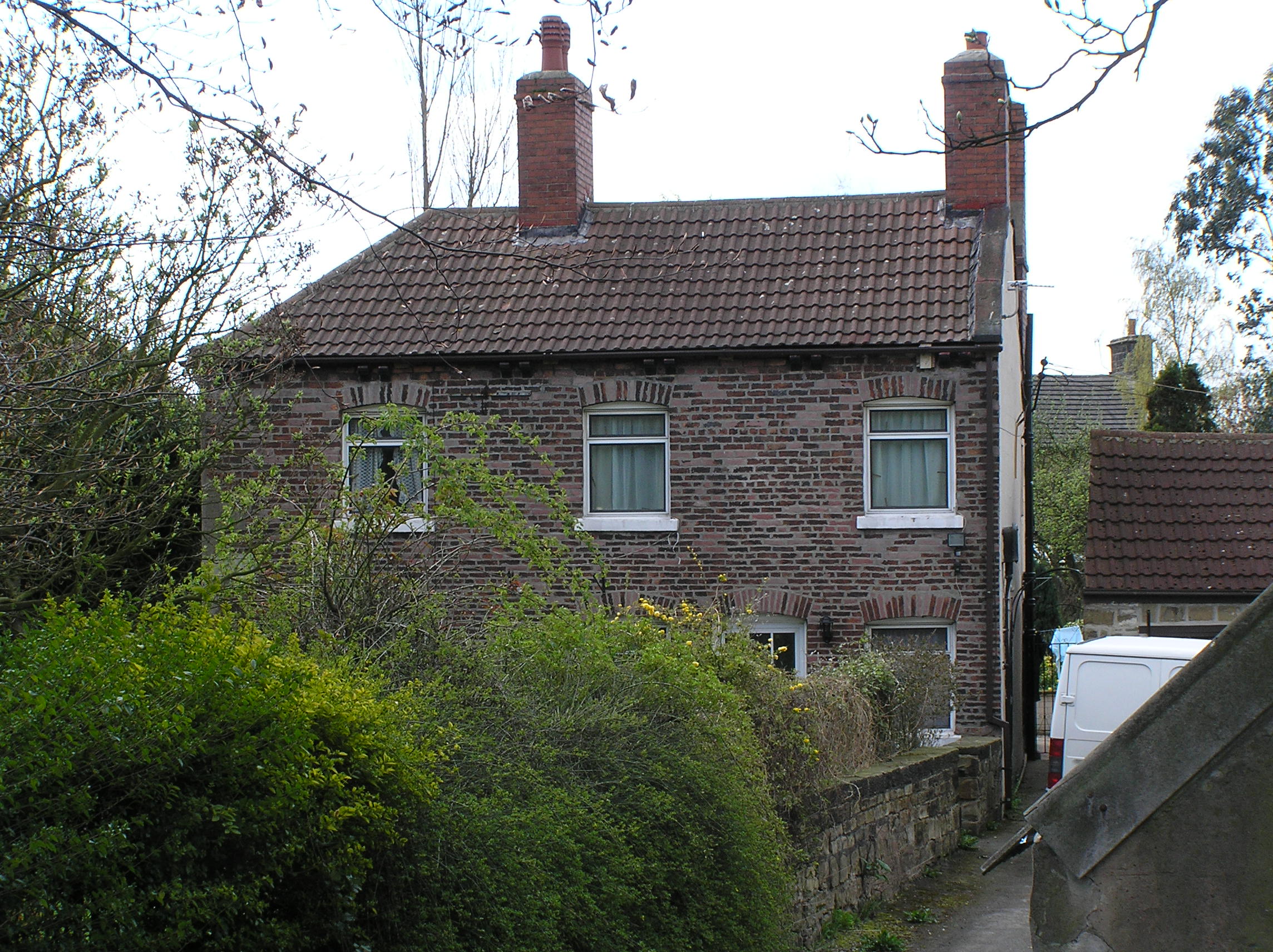
Red House Farm
By
1861
the family had moved to what is now Elms Farm on Common Road Brierley.
Here Mary Dymond aged 54 lived with her son Thomas who was a land
surveyor, James who worked the 102 acre farm, and her daughter
Elizabeth. The family built a row of cottages opposite this farm. By
1881 Mary Dymond was living on Church Street. James Dymond now aged 46
and a Coal Owner, was living with his wife Mary and three children at
Elms Farm. Thomas Dymond aged 48 also a Coal Owner was living at
Burntwood Hall with his wife Anne (nee Tomasson), and two children. Her
third son John Dymond now aged 42 was a Colliery
Agent
Dealer
living at Ferney
House,
East Barnet,
London.
Thomas
Dymond
was born in 1833 and lived to be sixty-seven years old. He was the
manager of the Barnsley Main Colliery Company. He was married twice and
his first wife. Elizabeth died in 1866, at the age of only twenty-eight.
His second wife, named Anne, outlived him; dying in 1923. Thomas Dymond
bought Burntwood Hall about 1868 and it then stayed with the Dymond
family for almost a century. Burntwood has always been part of Great
Houghton but Thomas, being a Brierley man, had close connections with
the village. He was church warden for Felkirk and in 1876 gave three
bells to Felkirk Church when the tower was restored. Anne Dymond who was
born at Penistone, was the aunt of Beatrice Tomasson. Beatrice was born
at Barnby Moor Nottinghamshire and lived for many years in Gortnamona
House Clontuskert Ireland, she came to live
at Burntwood Hall as governess to Anne's daughter Catherine. She later
became known as leading lady a mountaineer. Thomas’s son by his first
wife was educated at Eton, he inherited Burnwood from Anne Dymond nee
Thomasson in 1923 he died in 1940 and the estate passed to Robert Dymond
born in Felkirk in 1876 who was a solicitor,
and the son of John Dymond of Ferney House
London. In 1911 he was a Solicitor at the Civil Service Estate Duty
Office Middlesex.
On
the
death of Robert Dymond in 1960, the Dymond
estate was sold off. Burntwood Hall became the property of Dr.
Ross-Gardener a well remembered doctor at Brierley and later passed to
his son Mr. Douglas Ross-Gardner, it is now a residential care home for
the elderly. Howell Wood is now the property of the new West Yorkshire
County Council.
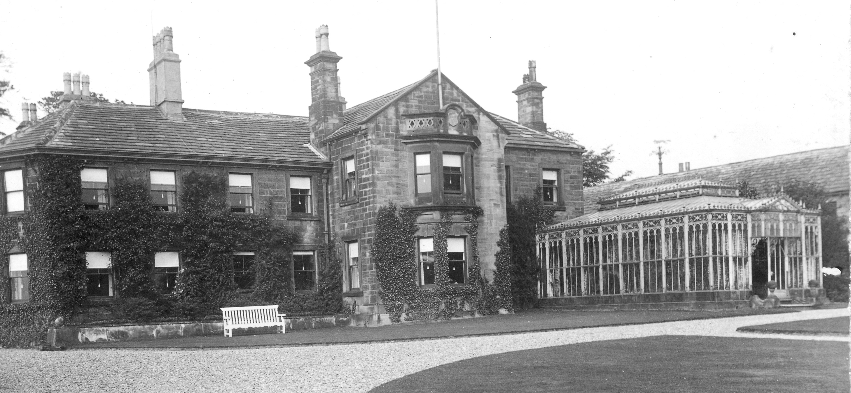
Burntwood Hall, please see photos at
Http://www.oldbarnsley.co.uk
The Hoyland family, as mentioned earlier, lived at
Grimethorpe Manor House, but some time before 1720 John Hoyland
became tenant of Ferry Moor Farm. Then in his will dated 20th. May
1731 he refers to his Dwelling House with Gardens and Orchard in
Brierley, the first mention of the building now known as Brierley
Hall. The Shirtliffe family followed the Hoylands at Ferry Moor.
Joseph Shirtliffe died there on 23rd September.1761, aged
forty-four. In Leeds
public library there is a plan of the estate at Ferry Moor as it
was in 1778. The estate is in the
name of the Right Honourable Earl of Mexborough, one of Sir George
Savile's titles.
On
the
1841 census Robert Hoyland is described as being a
solicitor aged 44, with his wife Elizabeth aged 39. Robert
Hoyland’s
daughter Sarah married Godfrey Pigot Cordeux of Barnsley who became the
curate of Brierley. The family continued to live at Lindley house
following the death of Robert and the corner on which the house stands
became known as Cordeux Corner.
John Hoyland (there were
many Johns in this family over the years) was living in the
building that was to become Brierley Hall in 1841 with his wife
Mary. John bought a considerable amount of land on
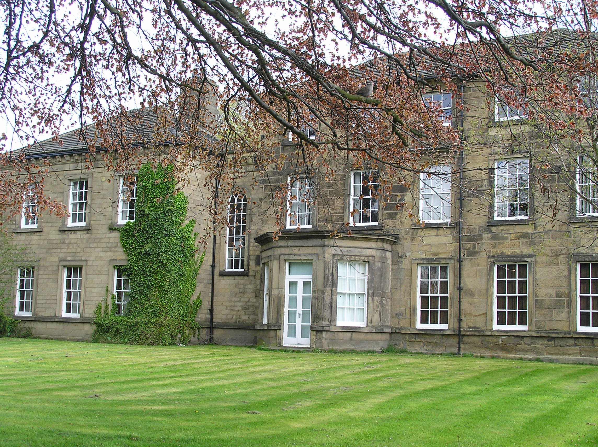 |
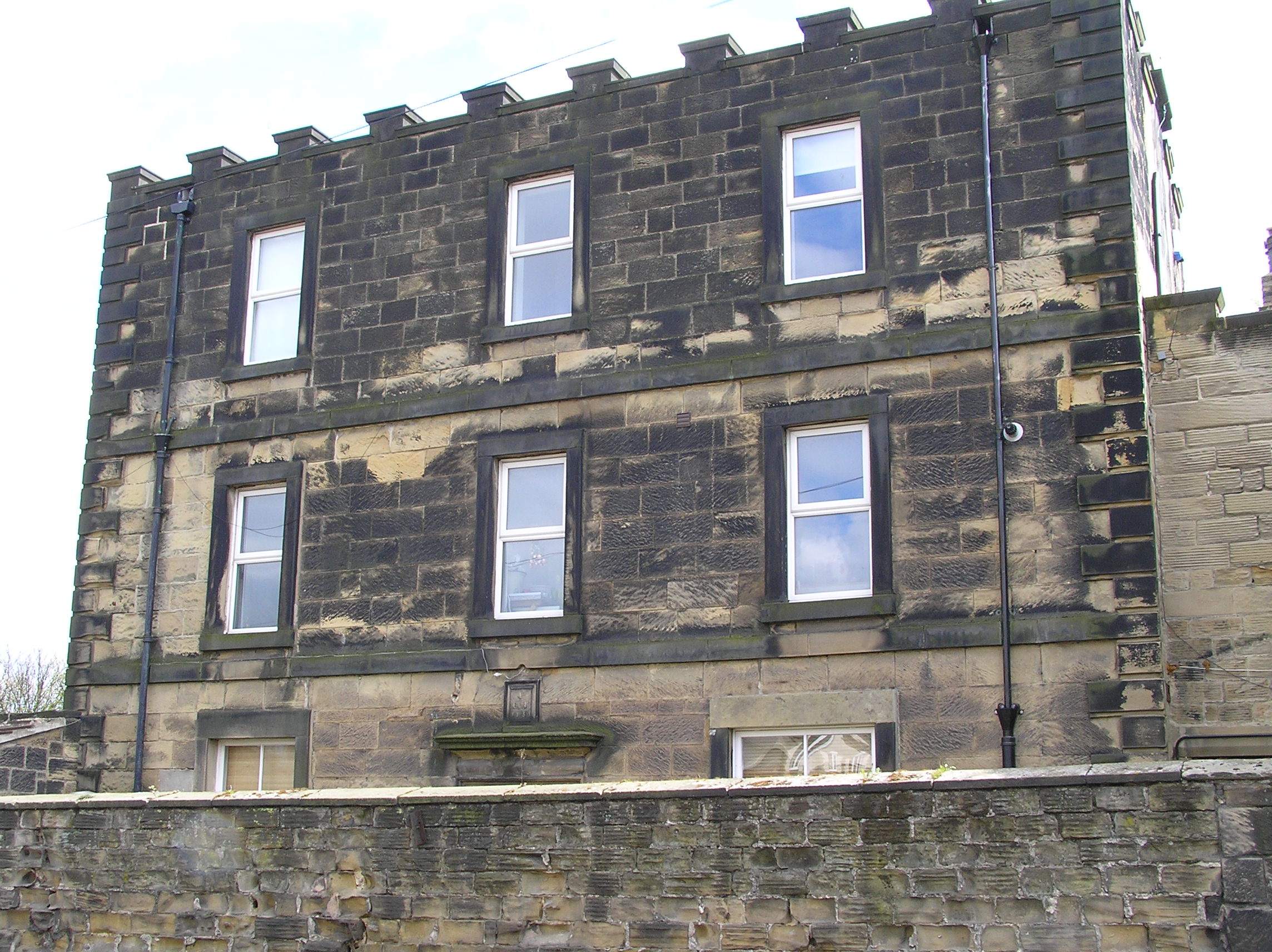 |
| Brierley Hall |
Lindley House |
His son the Rev.
John Hoyland was educated at
John and Thomas Cordeux were Linen Manufacturers in Barnsley with large estates including lands at Hunningley and Stairfoot. In 1856 they had a linen warehouse with a rateable value of £70, this was located on Sheffield Road Barnsley. John, who lived at Hunningley Villa Ardsley, married the daughter of Godfrey Pigott of Bolton upon Dearne. Another member of the Pigott family was John Birks Pigott a wealthy Barnsley Linen Manufacturer. His linen mill was known as Shaw Mill, it stood on the corner of Race Common Road and Shaw Lane Barnsley.
The son of John Cordeux, Rev. Godfrey Pigott Cordeux MA was born in 1829, he was educated at Worcester College Oxford. On the 11th. December 1855. he married Sarah Hoyland, daughter of Robert Hoyland of Brierley, At that time Godfrey was incumbent of St Leonards, New Malton. They lived at old Brierley Hall and gave it the new name Lindley House. They had three children Edith born in 1863, Robert born 1865, and Edward born 1866.
Robert and Edward Cordeux were educated at Edenfield House Boarding School Thorne Rd. Doncaster. Edward died in 1884. Robert became a Bachelor of Medicine, and in 1899 lived at West Bridgeford Nottingham. His son Edward died on the WW1 western front in 1915. Godfrey's sisters Ellen and Fanny never married; they had a family pension, and lived at Cliffe House, Quarry Hills near the railway station at Darfield.
In 1869 Robert Hoyland who was a
solicitor, his brother Rev. John Hoyland vicar of Felkirk, Rev. Godfrey
P. Cordeux, his father John, and George Savile Foljambe, lord of
Brierley Manor, established a new church and church school in Brierley.
The lands for the school were divided between Rev. John Hoyland vicar of
Felkirk, and Rev. Godfrey P. Cordeux, with the larger share going to
Godfrey. In 1898 the school was enlarged to take 90 pupils, and again in
1916 to take 160 pupils.
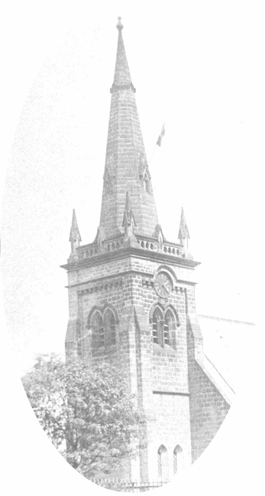
Brierley Church
It was written into the deeds for the school that if the school became disused the lands would revert to the Foljambe and Cordeux families. (School Croft was listed as Cordeux land on a map attached to a deed dated 1937). This arrangement was intended to protect the property for the benefit of the village, but has led to a situation where the old school has stood empty for many years. In the late 1970's a new school was built on nearby land, this was opened in 1981. In 1982 a Brierley Community Association acquired use of the building for use as a village hall but a few years later the project fell through due to lack of funds. Rev. Godfrey died in 1907. His daughter Edith purchased Jennett Croft from Clement Edward Hoyland in 1911 on which to build a village hall. This was known as the Church Institute. Following her death in 1928 this passed to Wakefield Diocese. For a number of years the hall housed an extra school class room. It is now a public house. At the same time as there were no male heirs a trust which is still in existence was set up to look after Cordeux interests in the area. In 1881. Robert Cordeux of Brierley aged 16, his brother Edward 5, and Clement Hoyland 11, were at Edenfield House Boarding School, Thorne Road, Doncaster, Yorkshire.
This was run by Mrs. Catherine Lane aged 61 from Bingley, with her 4 daughters. The corner on which Lindley House now stands is known as Cordeux Corner. The population of Brierley was now almost five hundred and the chart shows the trades in the village in 1877. William Hanson's smithy stood at the end of Church Street, opposite the Three Horse Shoes Inn, where there is now a level piece of land cut into the retaining wall of the higher field. William and his father George from Hemsworth had taken over the blacksmiths shop of Joseph Askin in Brierleyabout 1852. By 1907 Clifton Villa Brierley had become a home of the Hanson family. In 1881 it was the home of Rev. Josiah Harris a Wesleyan Methodist Minister. Cliffton Villa is now the village post office. Charles Hanson was the last blacksmith here, the smithy closed down beteewn 1927 and 1936. William Watson's Blacksmiths shop stood opposite the Church next to the village pinfold it closed down about 1893. Two cottages at the other side of the pinfold are marked on the 1854 Ordnance Survey map as Towns Houses, these were in the care of 'The Overseers for the Poor'. The Farriers Arms Inn was in the cottage at the other end of Church Street, opposite Lindley House. This cottage is built in the Long House style, with the living area and barn under the same long roof. There are several of these cottages in the village, each with its gable end built in line with the road, giving the cottages the appearance of standing in their own short lanes. The better known farms were occupied as follows:
Mr. Herbert Hawson at Brierley Manor
House. John Horn at Ringstone Hill Farm. Mr. James Dymond at Elms Farm.
Mr. Thomas Miller at Fold Head Farm. Mr. Edward B. Crossley at
Grimethorpe Manor House. and Mr. George Horn at Grimethorpe Hall.
From about 1840 to
1887 a family called Dunhill farmed in Brierley their farm house stood
where Violet Farm Close is now next to Lindley House. John Webster
Dunhill who was born in Brierley emigrated to
At this time there were at least three wells in use in Brierley village. These were- a draw well on Church Street opposite Brierley Hall, the Cobblers well close to the Farriers Arms and Royd Well near Elms Farm Common Road. Whilst at Grimethorpe there was a water pump and well near the Green.
Brierley was now a large village or township with some ten to twelve farms.,several market gardens and many tradesmen including saddlers, blacksmiths, shoemakers and tailors; whilst at Grimethorpe there was the Hall, Bridge Farm, Grimethorpe Cottage by the corn mill, Fold Head Farm, and the Manor House which stood where King Street now is. Up to now Grimethorpe had been the sleeping hamlet of Brierley but in the latter part of the century the point of change for Brierley and Grimethorpe was to come.
| Brierley Traders 1877 | The population or Brierley with Grimethorpe | |||
| Backsmiths | William Watson | 1851 |
386 |
|
| William Hanson | 1861 |
491 |
||
| Butcher | Arthur Kenyon | 1871 |
384 |
|
| Carpenter | Charles Jennet | 1881 |
484 |
|
| Tailors & Drapers | Squire Hattersley | 1901 |
1,684 | |
| Charles Tasker | 1911 |
3,876 | ||
| Samuel Dearden | 1921 |
4,692 | ||
| Inn Keepers | Three Horse Shoes William Thackery | 1931 |
6,723 | |
| Thre Farriers Arms William Watson | 1851 |
7,090 | ||
| Market Gardeners | Henry Kenyon | 1961 |
8,259 | |
| Charles Edward Kenyon | 1971 |
7,851 | ||
| George Kenyon | 1972 |
Brierley 1,829 | Grimethorpe 5,559 | |
| Post Office | Joseph Wilson | |||
| Shoe Makers | John Broomhead | |||
| George Fox | ||||
| Richard Sunderland | ||||
| Stone Mason | Thomas Rogerson | |||
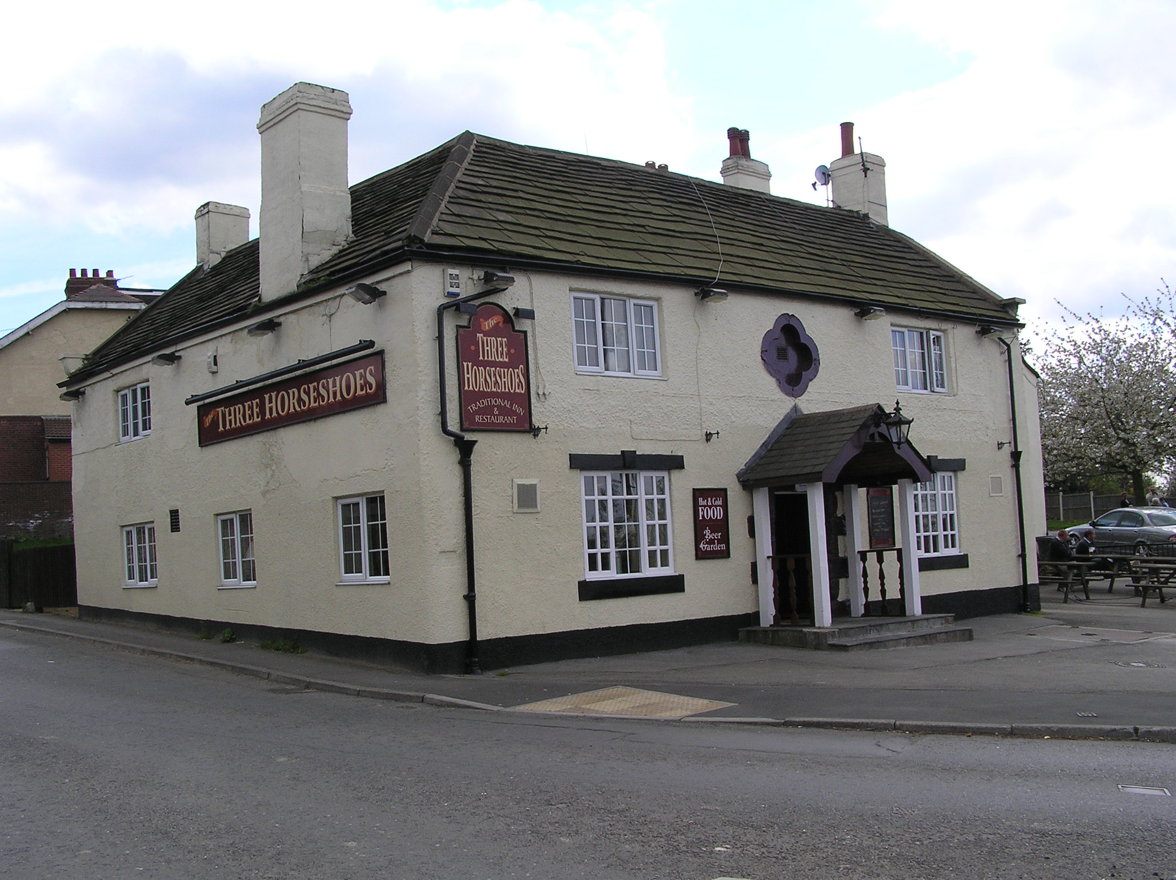 |
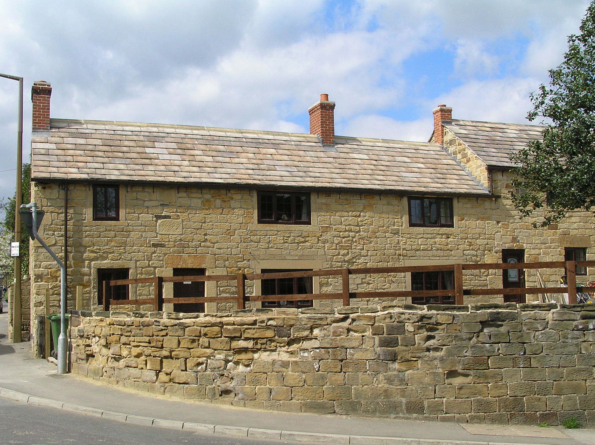 |
| Three Horse Shoes
Inn |
Farriers Arms
Inn now a cottage built c1650 |
First of all on the 28th of May, 1879, a decision was taken by the Hull, Barnsley and West Riding Railway and Dock Company to build the Hull and Barnsley Railway which passes Brierley on the north-west side. The line was opened on the 20th of July, 1885. Its six hundred and eighty five yards long tunnel was cut to take the railway through Brierley's high ridge. At its peak the railway could run a passenger train from Hull to Cudworth in seventy seven minutes. Whereas the North Midland Railway had been the first large line planned through South Yorkshire, this Hull and Barnsley line was the last, other lines only being in-fillings on the established grid. The Dearne Valley Railway was one such line. Built in 1912, this linked the Lancashire and Yorkshire Railway with Doncaster and had a Halt at Grimethorpe. In 1894 the Hemsworth Infectious Diseases Hospital was built near Brierley Common at a cost of nine thousand, seven hundred pounds. This is now known as Burntwood Hospital.
Then, a year later, in 1895, came the great change when Grimethorpe Colliery was opened. Many of the miners who came to live and work at Grimethorpe would come from the closing mines of Silkstone and Barnsley, and for a time would catch the train to Cudworth station and then have to walk from there to start their shift at Grimethorpe. Their walk would take them along part of what could be the old road from Monk Bretton Priory to Hall Steads which is marked by a series of paths and road between the two places though much of it has changed. From the Priory it now starts as a path up to Cundy Cross roundabout. It then follows the line of the new Barnsley road past the bare hilltop of the old wood of Lund, then down Station Road to the railway station at Cudworth, up from there on to New Dale Avenue, through a stone gateway to Newton Avenue, then up Jenny Lane past the site of Cudworth Manor, over High Royd. High Royd is the probable site of a small fort in Cudworth which was a ruin in the early years of Nostell and Monk Bretton Priories, its name at that time was Ueggekastel. The old road then goes on to the Pinfold site, from where it follows the winding path to Ferry moor Farm. A new straight path now runs past the Dorothy Hyman Stadium to Ferry Moor. From there the path goes on to Grimethorpe past the site of the Manor Farm, on behind the church to Burnt Wood Road, Grimethorpe, from where it goes down to Hall Steads. When seen on a map this line of paths and roads follows a gentle right hand curve from the priory to Grimethorpe. From the hill top of Jenny Lane, Cudworth, the old road can be viewed for most of its length. There is a diversion at Ferry Moor caused by the building of railway sidings.The line of the old path there is marked by several large trees which are the remains of an avenue of trees that led to the farm.
The total effect of the changes that large-scale
mining brought to the area, and a history of the mines themselves is
beyond the scope of these notes. However, some statistics are available
which help to form a picture of the village at that time. The
first
effect of the opening of the mines or collieries was
an immediate and massive increase in the population of
the village as the chart shows. In 1881 the population
of the combined
The growing
population needed new housing estates. These were built in
Grimethorpe in the uniform red brick of the period, on a scale large
enough. to eliminate the old field pattern of the hamlet. In
Brierley, however which remained largely agricultural, the smaller
housing estates still retain the form of the fields and crofts of
old Brereley.
The first
phase of new housing at Grimethorpe was off High Street in the
area of
Fresh water supply was needed
for the increased population, the wells
which had served the villages were now inadequate.
Hemsworth R.D.C. built a reservoir at Ringstone
Hill to supply Brierley and Grimethorpe with piped water for
the first time in their history. What a change this would have been for
the older residents.
In 1901 Oak Tree
House Grimethorpe was the home of Robert Walters aged 29 a
mining engineer. He was the son of Hargreave Walters also a
mining engineer of Castle Gresley near
The Lord of Brierley Manor was now Francis John Savile Foljambe, the son of the George Savile Foljambe who had founded Brierley Church. The manuscripts of this lord of Brierley were collected by the Historic Manuscripts Commission and published in 1897. Unfortunately this publication did not include the Brierley Manor Court Rolls. In 1904 Grimethorpe Church was built, the hamlet having become an ecclesiastical parish in 1901; and Ferry Moor Colliery was opened in 1917.
In 1910 the Hodroyd Coal Company planned a mine in Brierley to take coal from the Shafton seam. Two shafts were sunk to the seam at a depth of 224 yards; these were completed on the 23rd of April, 1912. A tramway was built to carry the coal to the washer at Ferry Moor. This tramway also carried waste to the tip at Peter Wood. The area mined covered 4,000 yards to the north east of the shafts and 1,100 yards to the south west where damp made further working impossible. Dampness was a problem throughout the workings as there was a water bearing rock above the coal seam.
Captain Roland Addy became the managing director of the Hodroyd Coal Company, and in 1916 the company bought Brierley Hall. Captain Addy lived at Brierley Hall untill 1948, and extended it, having the north wing built in the same stone as the older Georgian style section. Captain Roland Addy was the son of James Jenkins Addy a colliery manager form Ecclesall Shefield. Roland Addy was born in 1893 at Hodroyd Hall Felkirk but the family soon moved on to Osborne House Monk Bretton. Osbourne House is a Georgian House standing in its own tree enclosed grounds close to the Sun Inn.
In 1948 the coal mines were nationalised
and Brierley Hall along with many other large houses in the
area belonging to Coal Companies became the property of the
National Coal Board. Grimethorpe Hall suffered the same fate.
From the N.C.B. the hall passed to Hemsworth Rural District
Council then Barnsley MBC. It was
purchased by a private contractor in the summer of
2009.
The opening of the short-lived colliery resulted in the building of only two streets of terraced houses and the opening of the inevitable Co-op. The Co-op which has now closed was built on the sharp corner at the north~west end of Church Street, on a piece of land known as Coward Croft. With the arrival of new inhabitants, several districts of Brierley and Grimethorpe received new names; Hall Steads became The Willow Garth; Tom Bank became The Dell; the joint Woodlands of Great Houghton Common, West Haigh Wood, and Lady Wood, became Grimethorpe Wood; and the waste tips of The Hull and Barnsley railway line became known as The Cow Mounts.
Grimethorpe Manor House had been pulled down to make way for King Street; and Bridge Farm, standing near the village green, became known as Grimethorpe Manor Farm.. Brierley Church Institute was built in 1911 and five years later because of the increase in population, due to the opening of the mine, it was necessary for the church school to be extended, a new part being built in front of the old one.
Colonel Foljambe's Estate, To be sold by auction by Messrs. Lancaster & Sons
at the Roya1 Hotel, Barnsley, on Wednesday the 29th of 0ctober , 1919, a t 3 p.m. precisely .
Lot 77-Brierley Manor Farm, with 171 acres of land rent £184, tenants The Carlton Main Colliery Co., with lands at Willow Garth, Spar Well and Tom Bank.
Lot l8~The woodlands of New Park Spring, 120 acres, and Lady Wood, 46 acres.
Lot 16~~Ringstone Hill Farm, with 132 acres of land rent £79 6s tenants The Carlton Main Colliery Co.
Lot 4~Fidling Farm, with 89 acres of land, tenant Mr John Tinker.
The area under the influence of Brierley Manor had by now been reduced by various sales to lands in Brierley, Grimethorpe, South Hiendley and Shafton. Each of these villages had its own sub-manor house. The one at Grimethorpe has already been mentioned; the one in South Hiendley stood on the south west corner of the junction between Main Street and Kirk Gate, the road leading to Felkirk. This Manor house had extensive gardens and a large fish pond, the remains of this pond can still be seen about three hundred yards along Kirk Gate. Shafton Manor House stood to the south-west of the road at Dog Hill; this may well have been the site of the earlier manor of John Harryngton. Both these buildings are now in use as private residences.
The 19th century road through South Hiendley followed a very winding course. Coming from Brierley it turned sharp left at South Hiendley Manor House, then sharp right to become Tun Lane, then on to Havercroft via Westoff Lane.
South Hiendley and Brierley Commons are the only ones to have survived as open land, though much of Brierley Common is now under the plough. The common at South Hiendley is in two parts one on each side of the road from Brierley and covers 47 acres. South Hiendley pinfold stood at the western end of the common. Brierley Common has retained its original shape and parts near to the village are still open land. It lined both sides of Common Road from the place called The Flashes as far as the cross roads on the Rotherham to Wakefield Road, then both sides of this road as far as Burntwood. and covered an area of 134 acres. The commons were waste lands used for grazing and were the joint property of the Lord and Freeholders of the manor
Colonel Foljambe had inherited the estates of Francis John Savile-Foljambe and in 1919 the Manor of Brierley was sold.(An extract from the Sale Documents is shown)
The Court Leet of Brierley was retained; this is still held when there is sufficient business to warrant a meeting. In 1934 there was another change in Brierley when the Wesleyan and Primitive Methodists decided to unite. Each group left its own church and together they bought the Methodist Church, which is now in use and to which a fine new hall has recently been added.
Work at Brierley Colliery ceased for a while in the 1930's and in the next decade coal was outcropped on three sites in the village. One of these was to the east of Cliff Lane, one to the west of Ket Hill Lane and the other to the south of Frickley Bridge near the Hull and Barnsley Railway line. By 1949 al1 these sites had been restored to farmland. Plans of Brierley Colliery workings show that pillars of coal were left under the village and under some outlying farms to prevent subsidence. On January 31st. 1947. mining ceased at Brierley and the colliery became a training centre.
The mines in the area , particularly those at Grimethorpe and Ferry Moor, have gradually swallowed up most of the new park of the Saviles and are now, with their spoil heaps, creeping past Ferry Moor Farm on to Cudworth Common. The N.C.B. is doing much to restore this land by lowering the tips and covering them with soil.
Between 1959 and 1961 the spoil heap of Brierley Colliery was landscaped: 140,000 tons of red shale were removed. Together with the Forestry Commission, the N.C.B. planted 38,000 fir trees on the site of the tip and to ensure the development of the plantation planted 10,000 more one year later.
Even Brierley Hall has changed. Brierley became part of Hemsworth Rural District, and in the 1950's Brierley Hall had a brick section added when the hall became the Headquarters of the Rural District Council, which governed an area as large as the estates of Brierley Manor in the 16th and 17th centuries.
Another estate changed hands in 1960, when on the death of Roger Dymond, the Dymond estate was sold off. Burnt Wood Hall is now the property of Mr. Douglas Ross-Gardner, the son of a well remembered local doctor. Howell Wood is now the property of the new West Yorkshire County Council.
The West Riding and Hemsworth R.D.C. have now been replaced by West and South Yorkshire with the new Barnsley District controlling Brierley. Here again the past is being reflected, as the new Barnsley District closely resembles the old Wapentake of Staincross.In fact, the point where the new districts of Barnsley, Wakefield and Doncaster now meet is near the point where the Wapentakes of Staincross, Osgoldcross and Strasforth met, and the high north boundary of Brierley is now the boundary between West and South Yorkshire.
The Brierley Manor House is now the property of Mr. G. Kenyon and comes under the care of the Department for the Environment.
At the turn of the century, some visitors to Brierley, having come by train to Cudworth Station, walked, from there, the three long miles up to the village, along the old Hall Steads road. They gave to Brierley a name with which all its present and former inhabitants will agree – "That City Set On A Hill".
Since completing these notes in 1975 there have been many changes in the village. My story finished with the coming of deep coal mining and the arrival of a new population. A future historian could write about the rise and decline of coal mining and the development of Brierley as a dormitory village.
Transcription of the Brierley Manor Court Roll for 1655.
This is a transcription of the roll in full in so far as it is legible.
The words in inverted commas have been inserted where they almost certainly would appear to make the roll more readable.
Freeholders of the manor together with the Lord of the Manor made up the Court Baron. which in the case of Brierley seems to have been a very large court.
The Courts Frankpledge and Leet are dealt with together, being the courts for the tenants of the manor. In the context of this Court Roll the word Leet was used as a definition of the area under the jurisdiction of the court.
Besides the names of the freeholders and tenants are abbreviations to say: whether they appeared at the Court (ap). were exempt (ext). were excused in some way (es). or fined for non appearance.in which case the amount of the fine was stated.
The sums of money were in Roman numerals except for the totals which were in the conventional form. The fact that they do not add up correctly is probably due to the fact that some parts of the roll are illegible.
In the interest of accuracy the original spelling has been retained.
"Court Baron of the" Mannor of Brearley "In the year of our Lordl" One thousand Six hundred fifty & five before "John Stanhop" steward of the said Court. Freeholders in divers townshippes & hamletts
BARSLEY - WILLIAM Lord viscount Wentworth Earle of Straford (6s, 8d,) ARDESLEY - Henry Gascoyne Esq. (3s. 4d.)
BAWNE The heires of Sr Christopher Hilliard Knt (5s.) Richarcl Franke Gent ( as) Thomas Mayre ( 1 s. )
BARNEBY - Thomas Barneby Esq. (3s. 4d.) apt by Tho: Wildsmith by Atton (ext) BIRTHWAIT~ - Francis Burditt Esq, Sr John Kay Knt in right of his wife.
CAWTHORNE - Robert Hartcliffe of Cannon hall (1s.) William Bosevile Esq. (3s. 4d.) Mathew Lindley of Champney house (1s.) -- Francis Hague Carle Coates (1s.) Thomas Pasleiw The heires of James Washington gentleman William Green ( 1s.) John Mickthaite ( 1s,) Robert Harteley ( 1s.)
John Shirte (1s.) of Anne Cackehill (1s.) Thomas Oxley (1s) William) Pasleiw (1s ) Lionell Micklethwaite (1s)
CUDWORTH - Thomas Jobson Esq. (3s. 4d)
CHEVETT Francis Nevile Esq. (3s 4d.)
DENBY & BAG - Lionel Fanshaw gentl (2s) Thomas Burditt gentl (2s) Dele- -er Burdett gentl (2s.) Richard Clayton (1s.) John Shaw (1s.) Francis West (ap) Henry Hirst (2s.) Clark Henry Hugh (ls.l The heires of the wife of Henry Boothroyd (1s.) Robert Blackeburne (ap) se John Moseley (1s.) Joseph Moseley (1s.) Henry Dickinson (ls.) Thomas Wormall (1s.) Robert Ward (1s.) The heires of William Morehouse (1s.) Joanna Marshall widdow (1s.) Richard Marshall (1s) Thomas Hagh (es) Godfrey Bosville Esq (3s. 4d.)
HODROYD" -~ The heires of Richard Berry Doctor in phisicke (3s. 4d.) Henry Roe (es) in right of his wife Richard Gill (ap) in right of Elizabeth his wife
HUNSHELFE Sr Francis Wortley Barronett (5s ) Lewis West Clarke (did fealty) John Bagshaw (1s,)
INGBIRCHWORTH John Micklethwaite yong(r) (ap) Richard Micklethwaite (es) John N challs (1s,) John Waston (es) George Shaw (1s,) James Hinchclife (1s ) John Micklethwaite (did fealty)
HOULBECKE Miles Stapleton Esq, in right of Mary his wife (3s. 4d.)
KEXBROOK~ - Francis Burditt Esq. (apt by attor:) Sr John Kay Kt in right of his wife (ect) William Green (ls.) The heires of John Sale (1s.) George Beaumont gentle (2s.)Thoma s , Littewood (1s.) Thomas Hinchclie in right of Elizabeth his wife John Hall (1s.) William Coldwell in right of his wife (es )
KILLINGTON OVERHAGH Richard Osler (dead) (1s.) The heires of William Allan (did fealty) The heires of Marke Ward (1s.) Marke Skelton (1s.) Anthony V ton (es) PENYSTONE Ralph Wadsworth ( Is.) John Shaw of Sykehouse Clarke (2s.)
PILLEY - Sr Francs Wortley Barronett (5s.)
ROYSTON -~ Richard Cusworth sonne of Robert Cusworth (ap) Robert Wood gentl in right of Jane his wife (2s.) Robert Pitts (ls.) Gorus Bramhold (1s.) George Warin (1s.) Thomas Doliue (1s.) the heires of John Wood (1s.)
SKELMANTHORPE Hamlett Hide Esq. (3s. 4d.)
SHAFTON Richard Gill (ap) Henry Wroe in right of Sarah his wife (es) George Pitt (ap) Richard Gill in right of his wife (ap) Anthony Jenkinson (dead) Jonas Clarkson (ap)Robert Hellilay (es) John Stoley (did fealty)
SOUTHHINDLEY - James Liversedge (es) Anthony Goodwin (ap by Richard Bradley his Attor:) The heires of Richard Berry doctor in phisicke Jonas Smith (es) Francis Horne (ls.) James Green (es) Garthricke Watts (es) Francis Shepheard (ap) Robert Hudlestone (es)
THURGOLAND Lionell Bawlineforth Esq. (3s. 4d ) Thomas Kesworth gentl (2s.) Anthony Morewood gentl (2s.) Richard Cusworth of Eastfield (1s.) Thomas Hanson gentl (2s.) Thomas Hanson sonne of Richard Hanson (1s.) Richard Hoyland (1s.) William Ellyson (ap) Richard Wainewright (ls.)William Wadsworth (1s.) James Bowes (1s.) John Hobson (1s.) F ne Binnes (1s.) Ralph Warclsworth (1s ) John Ellis in right of his wife (1s.) Henry Shaw (ap) Richard Hey (ls.)The heires of Robert Kay (1s.) George Walker (1s.) Richard Wainewright of Storrs (1s.) John Hobson (1s.) Thomas Wager in right of his wife (did fealty)
WASBROUGH Francis Rockley Esq. (3s. 4d.) Daniell Ellis (ap) Widdow Taylor (ls.) William Skires (1s.)
BREARLEY Sr George Wentworth of Wooley Knt (5s.) John Rishworth (ap) Henry Wroe gentl (es) John Hellilay (ap) George Green (ap) James Dymond (ex) Jude Clarkson (f) Edward Firth (1s.) Robert Speight (lsf) Anthony Binnes (ap by Robert Budin Att:) James Liversedge (es) George Holgate ( 1s.) John Rishworth (ap) George Pitt (ap) Anthony Hellilay (es) William Wilson (did fealty) Thomas Wager (ls.) George Holgate (ap)
GRIMETHORPE ~~ Francis Pitt (1s.)
Tenants of 1 farme of youres & att will - Thomas Wood (did fealty) Anne Speight (ext) John Milner (did fealty) Elizabeth Green widdow (ap) Francis Wildsmith (ap) John Law elder (es) Giles Battyson (es) Alexander Berry (did fealty) Robert Speight John Law yong(r) (es) James Hirst (ap) William Yould (ap) John Bell in right of Agnes his wife (ap) Henry Fidling (ap) Thomas Hardman (did fy)
GRIMETHORPE - Henry Shirtclife (ap) Thomas Lee (did fealty) Richard Stead (ap) John Pitt (ap) Richard Marshall (ap) John Childe (ext) Gilbert Hoddgson (ext) John Swift (ap) Barbara Jennett widdow (es) Richard Speight (ap) widdow Bevers (ap) widdow Walker (ap) Bryan Medley (did fy) John Twigge (ap) Henry Pitt (ap)
SOUTH HINDLEY - Richard Milner (ap) Francis Shepeard (ap) Nicholas Hudlestone (ap) William Barbar (ap) Richard Shaw (es) Jonas Liversedge (ap) Thomas Hagh (es) Edward Barbar (es) Ralph Downes (ap)
THE NAMES OF THE JURY - ( Francis West gentl George Holgate gent John Micklethwaite gent) Sworne ( Richard Gill William Cawthorne Robert Blackeburne) Sworne (Jonas Clarkson John Hellilay George Pitt) Sworne (John Rishworth Richard Cusworth Thomas Wildsmith) Sworne (Jude Clarkson Darliell Ellis) Sworne
DENBY (57)-WHO prsent & say that lionel Fanshaw is dead butt doe not know who is his heire or heires (58) As also that Thomas Burditt is dead & that Thomas Burditt is his heire (59) As also that Richard Clayton is dead & that Thomas Morehouse enjoyeth the lands in right of his wife; As also that Edward Burgese is dead (60) And as for John Kay wee know him not but William Kay we know posesed of an Estate in Denby (61 ) Also wee find that Robert Ward is dead & that Robert Ward is his sonne & heire As for Thomas Wormall wee know noe such man
ROYSTON (62) And also that George Wood is dead & that John Wood is his Heire SOUTHHINDLEY (63) As also that George Shepheard is dead & that Robert Hudleston poseseth his lands
THURGOLAND(64) And also that Anthony Morewood is dead AND as touching all persons who have made default in appearance att this Court wee doe Amercie them. Namely such of them in the Summe sett over his head Also wee doe prsent Robert Burdin of Brearley for plowing the
land & mowing & taking away the Hay of Alexander Berry & doe Amercie him for the same 3s. 4d.Also wee doe prsent John Hoyland of Brearley hath not laid open his gate into Porter Croft & out according to a paine laid whereby he hath forfeited 30s.Also wee doe prsent that Thomas Smith deceased or Alice his wife did not lay open one Inrethin (f) or gap therein for the said way according to a paine upon the said Thomas Smith imposed where by there is forfeited 30s. Also we doe prsent that John Hoyland did goe over Thomas Wood ground wch was formerly widdow Starkes ground wih a wayne Contrary to a paine Laid whereby he hath forfeited 5s.Also wee doe prsent That the Inhabitants of Southhindley have not made sufficient horse way at Baynebridge gate wthin the feild leading towards Wakefeild According to a paine formerly laid whereby they have forfeited 30s. The summe of this Court £11-14s.~00d.
Jo Stanhope Steward
The Court Leett or veiw of Franke pledge holden att the Mannor of Brearley upon Tuesday the nyneth day of October 1655 for Sr George Savile Barronett before John Stanhope Esq. Steward there
TENANTS IN BREARLEY WILLIAM Cawthorne (ap) George Green (ap) William Yold (ap)John Law the the elder (es) Robert Hemingway Alexander Berry (ap) John Law yongr Henry Fidling (ap) Francis Wildsmith (ap) Thomas Shaw (es) James Dymond Thomas Wood (ap) Jude Clarkson (ap) John Hoyland (ap) Edward Wager (es) John Colly (ap) Abraham Woodhead (ap) John Bell (4d.) William Berry (4d.) James Hurst (ap) Arthur Cusworth otherwise Jackson (es) Robert Burdyn (ap) Thomas Waterworth (4d.) Richard Man (ap) Francis Wilkinson (2d ) Thomas Wood (6d) John Jennett (es) Thomas Oxley (2d.) Anthony Halliday (es) Giles Battyson Robert Speight (es) John Helliley (ap) John Milner (ap) James Fostard (ap) Willm Wilson (ap) James Batty (2d.)
TENANTS IN GRIMTHORPE. HENRY Shirtliffe the eldr (es) Richard Stead (ap) Henry Shirtcliffe the yongr (es) William Thorpe (ap) John Pitt (ap) Roger Cowper (es) John Oxley (ap) Joseph Greaves (es) Thomas Seed (2d.) George Houlegate gentl (ap) William Birkby (4d.) George Pitt (ap)
TENANTS IN SHAFTON'. ANTHONY Jnkinson gentl (dead ) Richard Marshall (ap) Henry Wroe gentl (es) Richard Reame (2d.) John Twigge (ap) John Childe (ext) Thomas Twigge (es) Richard Walker (es) Gilbert Horigson (ext) Henry Pitt (ap) Henry Walker (ap) Richard Speight (ap) John Twigge (ap) Jonas Clarkson (ap) John Ellis (ap) Bryan Medley (ap) John Swift (ap) Thomas Hardman ( ap) Peter Grmethorpe ( ap) John Berry ( es) Rich Gill ( ap)
.-TENANTS IN SOUTHHINDLEY . - SAMUEL Norkolke (e) Stephen Cuttell (es) John Wager (es) Edward Wager (2d.) William Barber (ap) Thomas Cuttell (ap) Nicholas Hudleston (ap) Francis Shepeard (1d.) Jonas Shepeard (ap) William Battyson (ap) John Shepeard (ap) John Shipton (ext) John Lister (es) John Battyson (ap) William Downes (es) Richard Bradley (ap) Thomas Hudleston (ap) Jonas Downes (ap) Ralph Downes (ap) James Greene (es) Edward Barbar (es) Richard Goodlove (ap) John Wiggin (es) Thomas Haigh (es) John Brettyiner (ap) Richard Shaw (es) Thomas Shaw (es) Jonas Firth (es) Edward Hoyle (ap) Abraham Shepheard (3d.) Thomas Firth (ap) Jonas Liversedge (ap) William Parkinson (4d.) Richard Milner (ap) Thomas Saunderson (ap)
TABLE OF ----Henry Fidling was Chosen Constable for Brearley & Sworne John Wager & John Colling was Chosen bylawmen & Aletasters for Brearley & Sworne
Richard Man is Continued Pinder for Brearley & Sworne
John Stoley was Chosen Constable for Shafton &Sworne
Richard Milner Chosen Constable for Southhindley & Sworn
Thomas Hudleston Ralph Downes Chosen Sworne men for Southhindley
Thomas Hudlesion ~ Ralph Downes Chosen Bylawmen for Southhindley & Sworne William Battyson & Jonas Downes Chosen Aletasters for Southhindley & Sworne
John Brettiner is Continued Pinder for Southhindley & Sworne
(Thomas Wood Richard Marshall John Hoyland) Sworne (John Swift Bryan Medley John Twigge) Sworne (Richard Milner Ralph Downes Francis Shepeard) Sworne (Thomas Hudleston Jonas Liversedge Willm Thorpe John Oxley) Sworne ,~~
& they doe prsent & say That Edward Bramwell Thomas Wright John Be!tham & Abraham Smith of Henley are residnts wthin the Leet that Richard Bromeley & Anne Dunnell of Shafton are residnts wthin the Leett-
jury doe Amercie all person who owe Suit to the Leet & have made default in appearance each of them over his head the Summe of this Court 07s.
( The figures and letters which appear in parentheses appeared above the line in the original documents.}
ACKNOWLEDGEMENTS
Nottingham County Record Office
West Riding County Library
The Yorkshire Archaeological Society
The British Museum
Cusworth Hall Museum
The Borthwick Institute
Leeds Public Library
Barnsley Public Library
Nottingham University
G. M. T. Foljambe. and many local people
Special thanks to Kim Watson (Dog) for help in field work.
BIBLIOGRAPHY
W. Bretton . - "Brierley with Grimethorpe". 1939
Ely Hoyle . –"History of Barnsley District". 1904
William Radclife . –"Notes on South Yorkshire" 1803
W. S. Banks . –"Walks about Wakefield". 1871
R. B. Smith . –"The Land and Politics of the England of Henry II".
Rev T Boyard Webster .- "The Ancient Parish of Felkirk". 1967
G. D. Parks - "The Hull and Barnsley Railway" 1959
J. A. Bulley . –"Hemsworth in History". 1959
Whites -"History of the West Riding". 1838
Kelly's Directory .-"West Riding". 1861~1936
E. A. Deighton and E. Hambleton "God is with Us".
J. Hunter . –"South Yorkshire". 1831
J. W. Walker -"The Priory of St. Mary Magdalene of Monk Bretton" 1926
The British Museum - "Archaeology of Yorkshire".
The Yorkshire Feet of Fines
The Index to the Wills in the York Register
The Brierley Manor Court Rolls and Rentals
Brierley Tithe Award 1841 Borthwick T A2755